- CryoSat
- Mission
- CryoSat Objectives
CryoSat Objectives
The aim of the CryoSat mission is to determine variations in the thickness of the Earth's continental ice sheets and marine ice cover. Its primary objective is to test the prediction that Arctic sea ice is thinning due to global warming. In addition, it was important to discover the extent to which the Antarctic and Greenland ice sheets are contributing to global sea level rise.
To achieve these goals, CryoSat will primarily:
- Determine regional trends in Arctic perennial sea-ice thickness and mass
- Determine the contribution that the Antarctic and Greenland ice sheets are making to mean global rise in sea level.
CryoSat's secondary goals are to observe:
- The seasonal cycle and inter-annual variability of Arctic and Antarctic sea-ice mass and thickness
- The variation in the thickness of the Earth's ice caps and glaciers.
Measurement Goals
The following science and measurement requirements had been defined (for typical spatial scales) to be observed over different targets:
| Sea Ice 105 km2 | Ice Sheets 104 km2 | Ice Sheets 13.8 - 106 km2 | |
| Minimum Latitude | 50° | 72° | 63° |
| SIRAL Mode | SAR | SARIn/LRM | SARIn/LRM |
| Requirement | 3.5 cm/yr | 8.3 cm/yr | 1.0 cm/yr (130 Gt/y |
| Measured | 3.0 cm/yr1 | 4.8 cm/yr2 | 0.2 cm/yr3 |
Extended Mission Objectives
After eight years of successful operations, CryoSat achieved its primary mission objectives for the cryosphere and has demonstrated a number of innovative methods that opened new observing possibilities and scientific streams in other domains. Due to its success, the mission operations were extended to 2021, and a new set of objectives were defined.
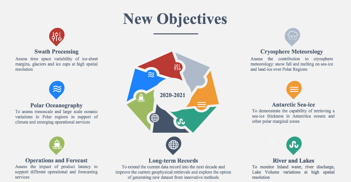
CryoSat is the first satellite to demonstrate the following:
- Evidence of the advanced performance of SAR mode altimetry over the ocean (leading to Copernicus Sentinel-3 operating globally in SAR mode)
- Coastal altimetry at high resolution
- Across-track interferometric (swath) processing
This has stimulated new scientific questions that require attention from the worldwide satellite and research organisations. The key arguments for extending the mission is to sustain the time series of a unique climate record of the full cryosphere and to present attractive scientific and technical goals that take into consideration a continuous dialogue with the scientific community and new open questions which have emerged from the previous phases. Although the objectives focus on what can be achieved in two years, they project into a long-term vision and into broader goals.
Science
Almost 80% of the Earth's fresh water is locked up in the cryosphere, i.e. snow, ice and permafrost. The cryosphere plays an important role in moderating the global climate - and as such, the consequences of receding ice cover due to global warming are far reaching and complex.
Due to its high albedo, ice masses directly affect the global energy budget by reflecting about 80% of incident sunlight back out to space. Thus, once formed, ice tends to be maintained. However, if ice cover were to decrease, less solar radiation would be reflected away from the surface of the Earth – causing the ice to absorb more heat and consequently melt faster still.
Around the North Pole, an area of sea ice the size of Europe melts away every summer and then freezes again during the winter. The thickness of Arctic sea ice plays a central role in polar climate as it moderates heat exchange by insulating the ocean from the cold polar atmosphere.
A decrease in sea ice could disturb ocean circulation in patterns in the North Atlantic As sea ice forms, the salinity and therefore the density of the upper ocean increase. The density increase causes the surface waters to sink – in essence acting as a pump, driving cold, deep ocean currents from the polar regions towards the Equator. A reduction in Arctic sea ice could significantly disrupt the Gulf Stream which transports warm surface waters northwards from the Gulf of Mexico to the sub-polar waters east of Greenland. It is thanks to the Gulf Stream that north-west Europe currently enjoys annual temperatures of about 9° C higher than average for the latitude.
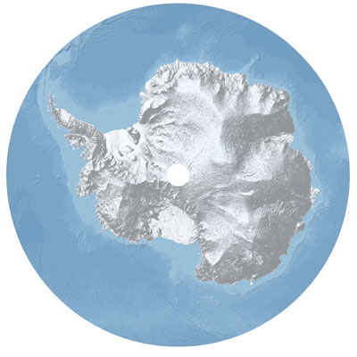
As well as influencing how much sunlight is reflected back to space, continental ice has an impact on sea level. The large ice sheets covering Antarctica and Greenland amount to about 28 million km3, which means that sea level is about 65 m lower than it would be if these ice sheets did not exist. Whilst evidence suggests that these ice sheets are relatively stable, there are indications that rapid changes are occurring around their margins.
CryoSat is dedicated to monitoring very precise changes in the elevation and thickness of polar ice sheets and floating sea ice. The observations that CryoSat makes is used to determine whether or not our ice masses are thinning due to global warming.
Learn more about recent findings from CryoSat mapping ice loss in Patagonia: