Featured
About WorldView-4
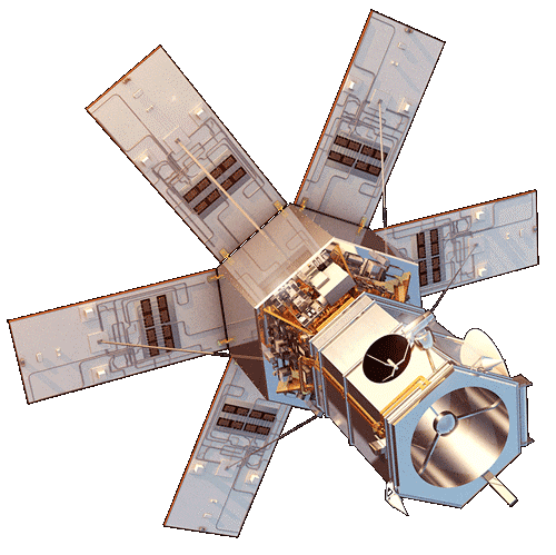
WorldView-4 was an imaging and environment-monitoring satellite from Maxar of the United States, which launched on 11 November 2016 to enhance European Space Imaging's customer offering with very high resolution imagery options.
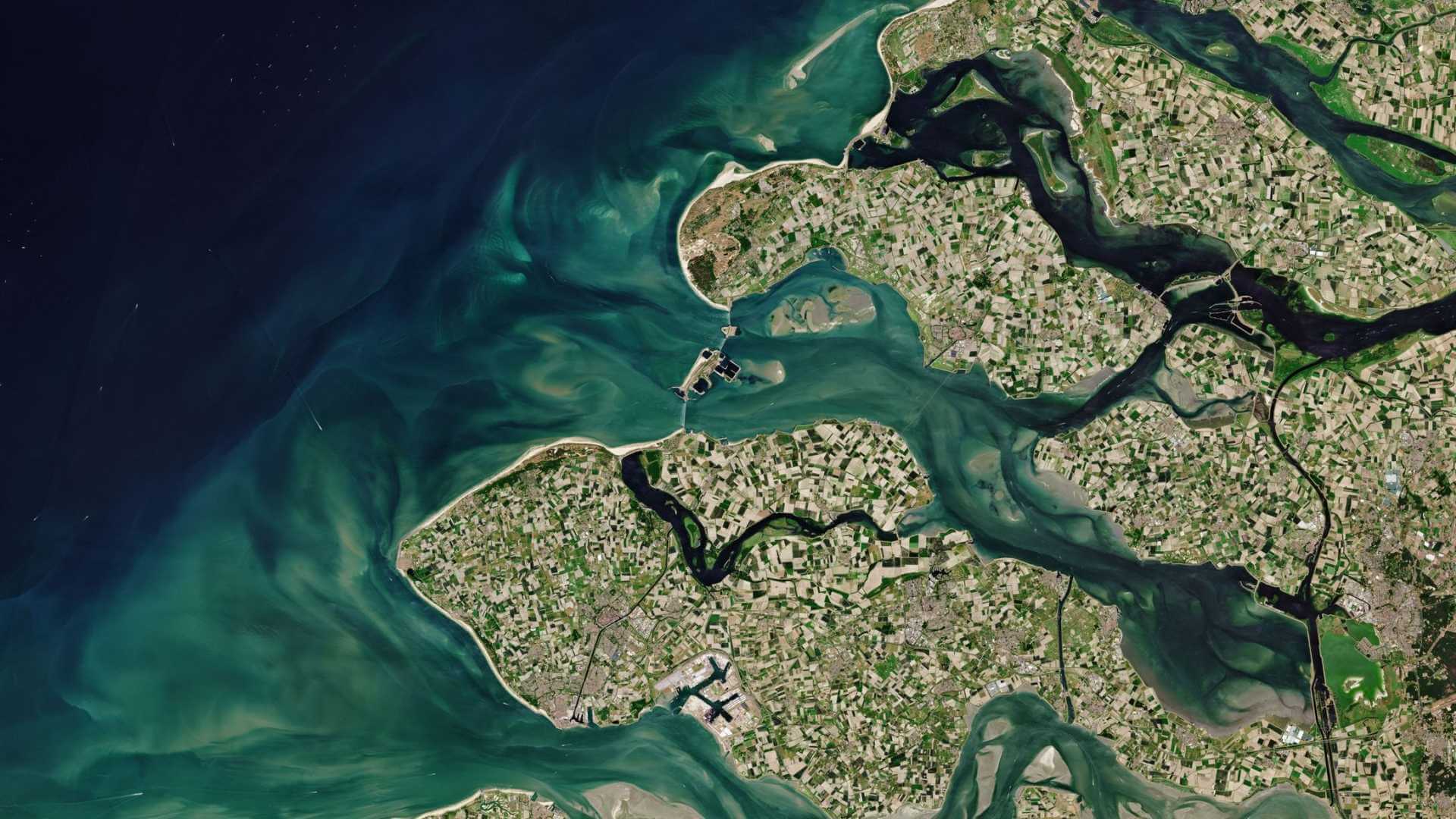
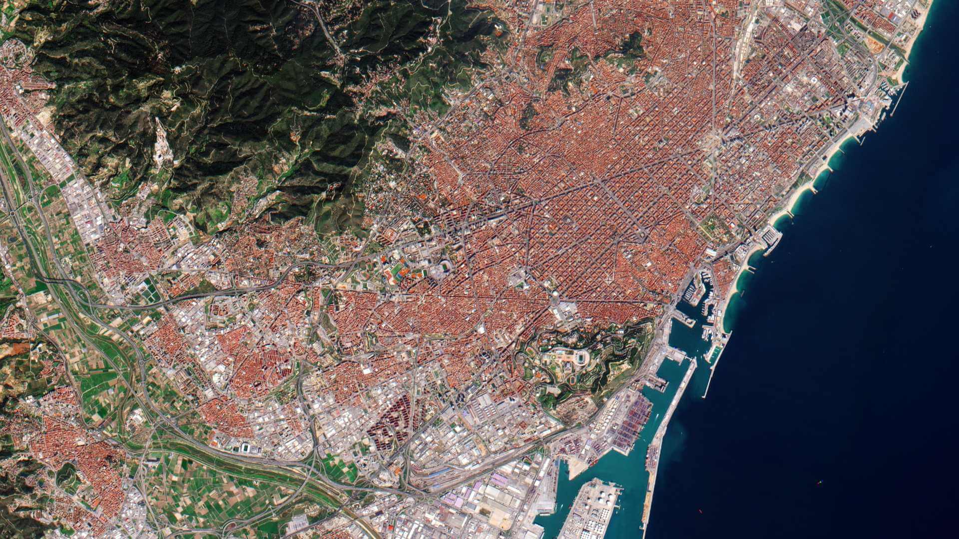
Operating in coordination with WorldView-3 and the other satellites of the WorldView constellation, it offered high-resolution imagery at 31 cm resolution in panchromatic mode and 1.23 m in multispectral mode; it provided large area single pass (synoptic) collection, which eliminates temporal variations and offers geolocation accuracy and bi-directional scanning with daily revisits.
On 7 January 2019, WorldView-4 was retired when the satellite experienced a failure in its CMGs (Control Moment Gyros), preventing the satellite from collecting imagery due to the loss of an axis of stability.
| Orbit Altitude | 617 km |
| Orbit Type | Sun-synchronous |
| Orbit Period | 97 minutes |
| Equator Crossing Time | 10:30am Descending node |
WorldView-4 Objectives
WorldView-4 offered multispectral, high-resolution satellite imagery; it was capable of collecting up to 680,000 km2 per day and had the ability to collect data for large-area mapping projects at the highest available resolution.
WorldView-4 Instruments
SpaceView-110 camera (WV110)
The WV110 instrument collected images at 0.31 metre panchromatic and 1.24 metre in the Visible and Near-Infrared bands. WorldView-4 was capable of rapid retargeting through the use of its Control Moment Gyros.
| Band name | Spectral band | GSD (Ground Sample Distance) | |
| Panchromatic Band (1) | 450 - 800 nm | Nadir: 0.31 m 20° off-nadir: 0.34 m 56° Off-Nadir: 1.00 m | |
| MS (Multispectral) bands (4) in VNIR (Visible Near Infrared) | Blue | 450 - 510 nm | Nadir: 1.24 m 20° off-nadir: 1.38 m 56° Off-Nadir: 4.00 m |
| Green | 510 - 580 nm | ||
| Red | 655 - 690 nm | ||
| Near-IR | 780 - 920 nm | ||
| Data Quantization | 11 bit/pixel | ||
| Swath Width | 13.1 km | ||
| Revisit Frequency (at 40º N latitude) | 1 m GSD: <1.0 day Total constellation > 4.5 accesses / day | ||
| Geolocation Accuracy | Predicted <5 m CE90 without ground control | ||
WorldView-4 Data
DATA COLLECTIONS
These collections are available as part of the Maxar Standard Satellite Imagery products and are distributed by European Space Imaging (EUSI).
ESA will support as many high-quality and innovative within the quota limit available, therefore only a limited amount of products can be made available to each project.
Moreover, ESA offers to registered users access through the Online Dissemination server to the following data collection: