- Learn & Discover
- Satellite data boosts global understanding of land surface
- Envisat is one of ESA’s pionee...
Envisat is one of ESA’s pioneering satellites for land surface monitoring
02 Feb 2022
Title:: Envisat is one of ESA’s pioneering satellites for land surface monitoring
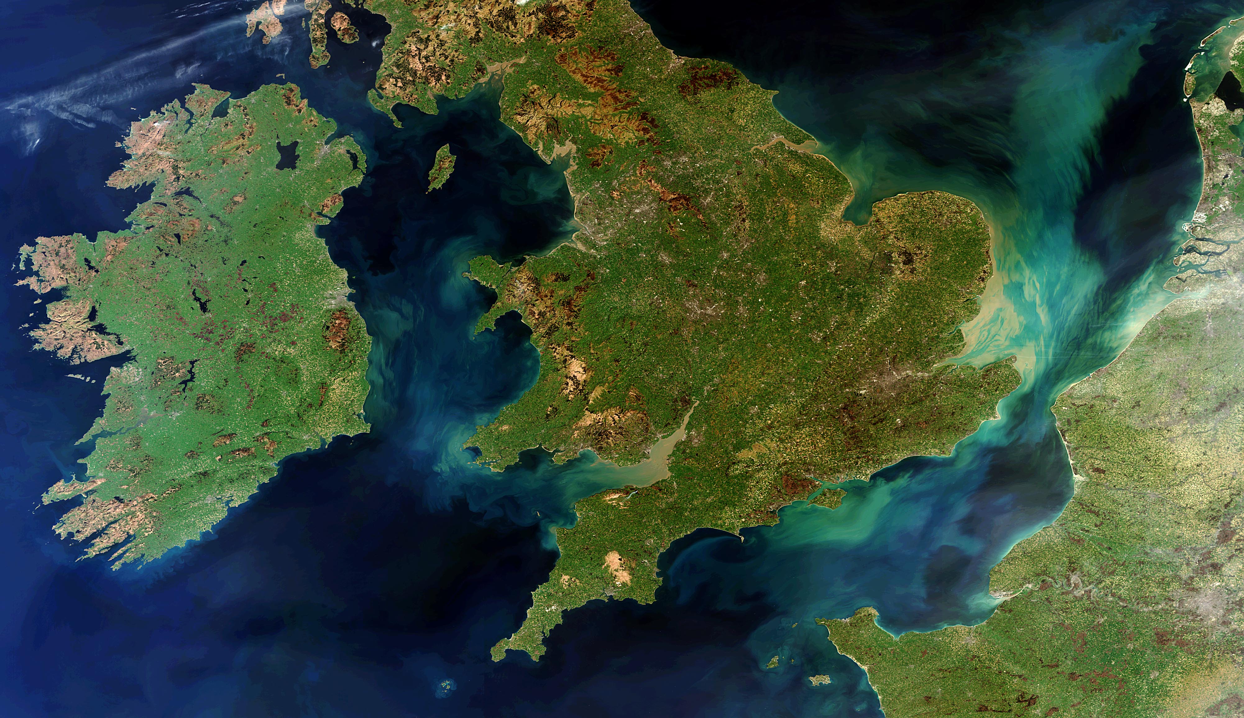
Description:This satellite land surface image acquired by the Heritage Mission Envisat in 2012 shows the lush landscapes of Ireland, Great Britain and northern France. The green and tan-tinted swirls in the seas and channels are due to sediments being transported in the water. Understanding coastal sediment dynamics is one application of land-surface monitoring facilitated by the Envisat data sets.
Copyright:ESA/Envisat – CC BY-SA IGO 3.0