- Data
- GEOSAT-2 Portugal Coverage 202...
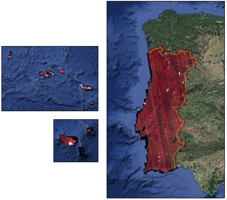
GEOSAT-2 Portugal Coverage 2021
Navigate To
How to Access Data
Fast Registration with Approval (Restrained)
- Go to the ESA User Services Portal
- Register or log in to EO Sign In - Users are required to provide their institutional email address when registering a new account
- Submit the form for accessing the data
- The request will be evaluated by ESA, which normally takes up to 2 days
- Upon successful evaluation, you will receive a confirmation email
- A second email will follow with details of where to download the data
- Search and download the products from the dissemination service (via a map).
The GEOSAT-2 products are freely accessible for Category-1 users in accordance with ESA’s Earth observation data policy.
An active EO Sign In account is required to download the products.
In ESA's Third Party Missions (TPM) dissemination service and catalogue the data is collection based and allows data browse and download through the treeview as well as via geographical search using an static map.
GEOSAT-2 products can also be discovered through ESA's Exploring Earth service, which allows users to browse and download products among the available datasets from ESA and Third Party Missions and instruments, using various criteria (spatial, temporal).
New users can register an account on EO Sign In. For further information about the EO Sign In Service you can visit TellUs.
Should you need support to access the data, please contact EOHelp.
Available to Residents of the Following Countries
Collection Description
GEOSAT-2 Portugal coverage is a collection of 2021 data over the Portugal area, including islands. The available dataset has a cloud cover less than 10%, and is acquired up to 1m resolution with Geometric accuracy <6m CE90 based on Copernicus DEM @10m.
The following product types are available:
- Pan-sharpened (4 bands, 321 Natural Colours or 432 False Colours): A four-band image, resulting from adding the information of each multispectral band to the panchromatic band. The fusion does not preserves all spectral features of the multispectral bands, so it should not be used for radiometric purposes. Resolution 1m; Bands: All, R-G-B or Ni-R-G
- Bundle: Panchromatic (1m resolution) + Multispectral bands (4m resolution): five-band image containing the panchromatic and multispectral products packaged together, with band co-registration.
The available processing level is L1C orthorectified: a calibrated and radiometrically corrected product, manually orthorectified and resampled to a map grid.
| Product Type | Processing Level and Spatial Resolution | |
| L1B (native) | L1C (ortho) | |
| Pan-sharpened | 1.0m | 1.0m |
| Bundle (PAN+MS) | 1.0m (P), 4.0m (MS) | 1.0m (P), 4.0m(MS) |
Technical Details
DATA SET SPECIFICATIONS
PROCESSING LEVEL
Having Problems Accessing Data?
Resources
Discover Latest Data
External Calibration and Validation of the Biomass Mission
ESA is pleased to announce the opening of the CAL/VAL Announcement of Opportunity (AO) call for the Biomass mission. With this call ESA invi...
SARSimHT-NG
The SARSimHT-NG campaign aimed to evaluate the feasibility of obtaining snow water equivalent (SWE) and surface soil moisture (SSM) measurem...
EarthCARE X-MET L1D Products
This EarthCARE collection contains the following data products: AUX_MET_1D: meteorological analysis and forecast fields X-MET provided by EC...
ICEYE Sample Data
Download free ICEYE sample datasets to preview products available for this mission....