- Learn & Discover
- CryoSat and ICESat-2 in harmon...
CryoSat and ICESat-2 in harmony over sea ice
03 Feb 2025
On 6 February 2025, the observations of the European Space Agency’s CryoSat and NASA’s ICESat-2 satellites will align almost perfectly with each other, providing the best opportunity yet to measure sea ice from space.
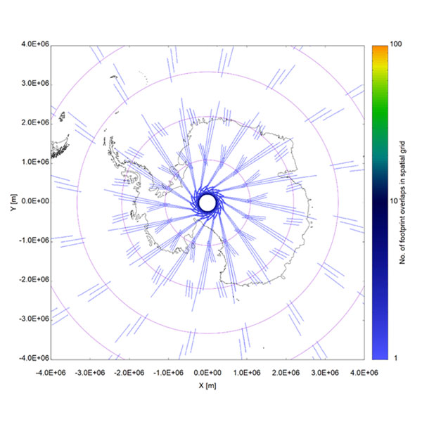
Ever since CryoSat’s flight operators made a subtle manoeuvre in July 2020, the satellite’s measurements have been converging ever more closely with those of ICESat-2, which orbits around 375 km lower than CryoSat.
On 6 February 2025, there will be a moment when both orbital planes will be aligned, crossing each other, before starting to slowly drift apart once again.
It’s a collaboration called Cryo2ice, which has combined the observations of two of the world’s greatest ever ice-monitoring missions to reduce the uncertainties associated with measuring ice from space.
CryoSat and ICESat-2 both measure the height of Earth’s surface but use different altimeter instruments. CryoSat, which has an unbroken almost 15-year record of global ice since its launch in 2010, carries a synthetic aperture radar. ICESat-2, which has flown since 2018, instead uses a photon-counting lidar.
Both methods have proven robust and accurate methods for remote sensing of ice. They have left us in little doubt as to the state of Earth’s cryosphere.
From the vast ice sheets covering Greenland and Antarctica to the sea ice covering the Arctic and mountain glaciers worldwide, ice is melting rapidly as the world warms due to human-made climate change.
A recent study combining measurements from both satellites showed that they agree to within 3% of the changes taking place over Greenland’s ice sheet, which shrank by 2,347 cubic kilometres between 2010 and 2023.
Orbital gymnastics
CryoSat’s flight operators at ESA’s mission control centre in Darmstadt, Germany, first manoeuvred the satellite to match observations with ICESat-2 over the Arctic.
The tweak of around 900 metres put the two satellites in alignment over the same stretches of ice every 19 orbits, which is roughly once every 31 hours.
Another adjustment in 2022 shifted the alignment to the Antarctic, coinciding with a campaign to monitor Antarctic ice on the ground to help calibrate and validate Cryo2ice measurements.
At the beginning of Cryo2ice, measurements were about three hours apart from each other, but this time difference has been naturally reducing over time. It is ultimately linked to separation between the two orbital planes.
“The current proximity of the orbital planes makes the time difference between CryoSat and ICESat-2 observations really small,” says Javier Sanchez Martin, CryoSat Flight Dynamics Manager.
“Even when not fully aligned, at the moment we are within 100 s difference, which for most scientific purposes can be considered as quasi-simultaneous.”
Cryo2ice’s quasi-simultaneous measurements offer such a good opportunity for sea ice researchers that CryoSat’s orbit will be tweaked once again to target the Arctic Ocean in the summer of 2025.
The uncertainties of sea ice and snow
Despite the agreements between remote sensors like CryoSat and ICESat-2, there remain uncertainties in mapping ice from space.
Sea ice, for example, is constantly drifting and shifting, meaning that satellite measurements taken at different times might not necessarily get a snapshot of the same ice.
Ice is also covered with layers of snow, which affect the signals returned from radar or lidar in different ways.
Work is ongoing to understand precisely how signals are scattered in the various layers of snow and firn, which have different properties such as density, but we know that there are differences in how each satellite detects the boundaries between ice, snow and air.
Both the dynamic nature of sea ice and the complexities of measuring snow are large sources of uncertainty.
The future Copernicus Polar Ice and Snow Topography Altimeter (CRISTAL) satellite aims to tackle this by measuring the same stretches of ice at the same time using radars of two different frequencies.
While we await the launch of CRISTAL, the date of which is yet to be confirmed but is expected to be around late 2027 to 2028, Cryo2ice offers a unique opportunity to bridge the gap in the satellite altimetry record.
“This will be a special year for cryosphere researchers,” says Tommaso Parrinello, CryoSat Mission Manager.
“This year marks CryoSat’s 15th year in orbit, and the 5th year of Cryo2ice. To get near-simultaneous measurements from two highly accurate and complementary satellites is a golden opportunity to hone our measurements of ice and pave the way for the next generation of dual-altimetry missions such as CRISTAL.
“I am looking forward to seeing how quasi-simultaneous measurements can improve our understanding of snow, sea ice and many other aspects of our polar regions.”