- All Categories (55)
- Data (10)
- News (15)
- Missions (6)
- Tools (5)
- Documents (19)
News - Infographics
Explore sample data products from Third Party Missions
ESA’s Third Party Missions programme consists of over 50 satellite missions from commercial and public organisations worldwide.
Data - Sample Data (Open)
IRS-P5 (Cartosat-1) Sample Data
Download free IRS-P5 (Cartosat-1) sample datasets to preview products available for this mission.
Data - Sample Data (Open)
IRS-P6 (ResourceSat-1) Sample Data
Download free IRS-P6 (ResourceSat-1) sample datasets to preview products available for this mission.
Data - Sample Data (Open)
IRS-R2 (ResourceSat-2) Sample Data
Download free IRS-R2 (ResourceSat-2) sample datasets to preview products available for this mission.
News - Data Release news
Sample data products from ESA’s Third Party Missions
Samples of data products from a range of Third Party Missions are now available to download, offering a preview of what these missions provide.
News - Thematic area articles
Cloud-free collections key for land monitoring
Satellite imagery is a crucially important tool for monitoring the land, but cloud cover can often block parts of Earth’s surface from view, limiting subsequent analyses.
News - Data Release news
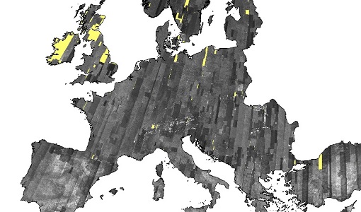
European Cities: Cartosat-1 Euro-Maps 3D DSMs and Ortho Images
ESA is pleased to announce that the Cartosat-1 Euro-Maps 3D Digital Surface Model (DSM) and ortho image products collection on European cities has been opened to users in the framework of Earthnet’s Third Party Mission Programme.
News - General News
International collaboration: Summarising ESA’s Third Party Missions
ESA’s Third Party Missions programme consists of more than 50 missions from around the world. Learn more about the Third Party Missions in this video.
Data - Fast Registration with approval (Restrained)
European Cities: Cartosat-1 Euro-Maps 3D
A large number of European cities are covered by this dataset; for each city you can find one or more Cartosat-1 ortho image products and one or more Euro-Maps 3D DSM tiles clipped to the extent of the ortho coverage. The Euro-Maps 3D DSM is a homogeneous, 5 m spaced Digital Surface Model semi-automatically derived from 2.5 m Cartosat-1 in-flight stereo data with a vertical accuracy of 10 m. The very detailed and accurate representation of the surface is achieved by using a sophisticated and well adapted algorithm implemented on the basis of the Semi-Global Matching approach. The final product includes several pixel-based quality and traceability layers: The dsm layer (*_dsm.tif) contains the elevation heights as a geocoded raster file The source layer (*_src.tif) contains information about the data source for each height value/pixel The number layer (*_num.tif) contains for each height value/pixel the number of IRS-P5 Cartosat-1 stereo pairs used for the generation of the DEM The quality layer (*_qc.tif) is set to 1 for each height/pixel value derived from IRS-P5 Cartosat-1 data and which meets or exceeds the product specifications The accuracy vertical layer (*_acv.tif) contains the absolute vertical accuracy for each quality controlled height value/pixel. The ortho image is a Panchromatic image at 2.5 m resolution. The following table defines the offered product types. EO-SIP product type Description PAN_PAM_3O IRS-P5 Cartosat-1 ortho image DSM_DEM_3D IRS-P5 Cartosat-1 DSM
Document - Data Access Information

ESA-archive-third-party-mission-collections.pdf
Discover the ESA archive data collections offered for the Third Party Missions programme.
Tools - Catalogues
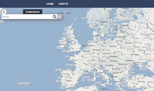
FedEO
FedEO is a data catalogue that provides a unique entry point to a number of scientific catalogues and services for, but not limited to, European and Canadian missions.
Tools - Catalogues
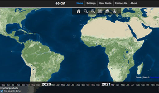
EO CAT
EO CAT is a data catalogue, offering a Next Generation Earth Observation system designed to manage end-user Earth Observation services.
News - Infographics
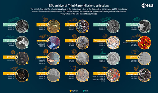
A summary of ESA Third Party Mission collections
A new summary is available, showcasing the ESA archives for Third Party Mission collections.
Document - General Reference
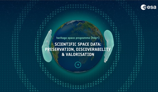
Heritage Space Programme interactive brochure
Learn about ESA's Heritage Space Programme in this interactive brochure.
Document - General Reference

Heritage Missions brochure
This brochure describes ESA's Heritage Space Programme and includes infographics describing some of the missions in the programme.
Document - General Reference
Third Party Missions Brochure
This brochure summarises ESA's Third Party Missions programme, providing a timeline and examples of content related to some of the missions.
News - Infographics
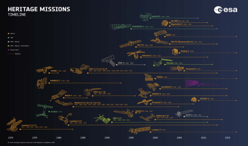
Timeline to over 40 years of historical satellite missions
ESA's Heritage Space Programme preserves historical data from over 40 years of Earth observation missions.
News - Infographics
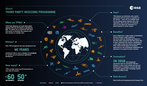
An overview of ESA's Third Party Missions programme
ESA’s Third Party Missions programme consists of almost 50 satellite missions, which are owned by organisations around the world. ESA has agreements with these organisations to acquire, process, and distribute data from their missions
News - Infographics
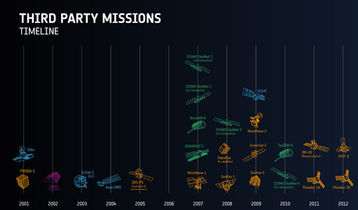
ESA Third Party Missions timeline
We've released a new timeline to illustrate the history of the ESA Third Party Missions.
News - Data Release news
IRS-1C/1D European coverages dataset available to users
Three European coverages (including Turkey) made by the Indian Remote Sensing Satellite IRS-1C and IRS-1D from the PAN sensor are now available.