- News
- ESA facilitates access to gree...
ESA facilitates access to greenhouse gas data
24 May 2022
Canadian company GHGSat Inc., which offers high-resolution remote sensing of greenhouse gas emissions, air quality gas, and other trace gas emissions from any point sources in the world—is now an ESA Third Party Mission.
As the international community strives to tackle the climate crisis, acquiring high quality data about greenhouse gas emissions is a priority. A specialist in the high-resolution sensing of these planet-warming gases from space, GHGSat, today announced that it has officially joined ESA’s prestigious Earthnet Third Party Mission (TPM) programme.
As a result, the agency is now distributing GHGSat data free-of-charge, to a wide scientific community upon approval of a project proposal. Making these datasets more available supports global efforts to reduce emissions of greenhouse gases.
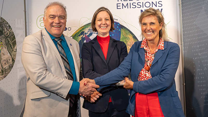
It was fitting that the announcement was made at ESA’s Living Planet Symposium in Bonn, Germany, one of the largest Earth observation conferences in the world, where the most eminent scientists and data users in the field are gathered.
GHGSat tracks greenhouse gas emissions around the world with unprecedented accuracy. Its datasets can be processed to generate maps that detail emissions from point sources as small as individual oil and gas wells.
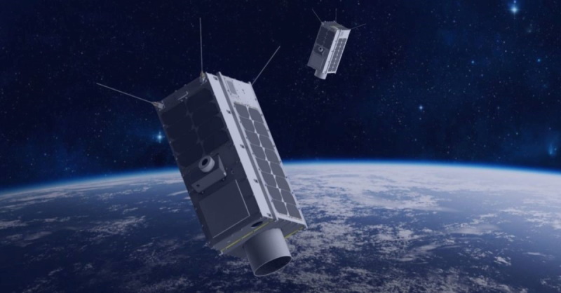
In June 2016, GHGSat Inc. launched its first satellite (GHGSat-D, or “Claire”) followed by the next two satellites (GHGSat-C1, or “Iris” and GHGSat-C2, or “Hugo”) in 2020 and 2021, respectively. In May 2022 GHGSat plans to launch an additional 3 satellites (GHGSat-C3, or “Luca”, C4 or “Penny” and C5 or “Diako”) and targets to expand the fleet to 10 satellites by 2023.
Each satellite is equipped with a hyperspectral imaging spectrometer operating in a narrow band of the short-wave infrared region of the electromagnetic spectrum.
This primary sensor collects measurements of vertical column abundances of greenhouse gas emissions, with both high spatial resolution (25 m), and high spectral resolution. GHGSat satellites typically deliver datasets with a field of view of approximately 12 km x 12 km.
See a summary of the GHGSat mission in our new infographic.
High resolution methane emissions data
Methane is now recognised as a major factor in global warming. While about 40% of methane emissions come from natural sources, the remaining 60% comes from human activity. Identifying – and rectifying - the source of human-made leaks has become a climate action priority.
GHGSat-D monitors both methane and carbon dioxide, while GHGSat-C1 and GHGSat-C2 are optimised to measure methane. GHGSat-D has enabled methane emissions from specific sources, such as oil and gas wells, to be detected from space.
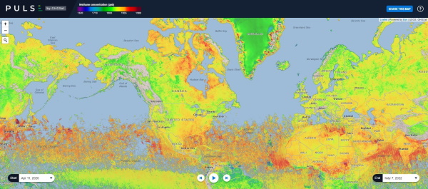
GHGSat-C1 offers improved performance and can image down to 25 m on the ground, doubling the frequency of the satellite revisit for any area. This enables GHGSat to spot even smaller methane leaks and track their source with even greater accuracy.
Peggy Fischer, Mission Manager of ESA Third Party missions at ESA, said “GHGSat data greatly facilitates the identification of methane hot-spots and emissions, supporting European scientific activities on monitoring of international climate treaties in synergy with Copernicus missions (e.g. Sentinel-5P).
“We are very pleased to be able to offer GHGSat data now to scientists for research projects and development of pre-operational applications, as part of the ESA Earthnet TPM programme.”
Data and users
Through ESA’s TPM programme, GHGSat data are now available to a range of stakeholders, such as researchers, businesses, regulators and governments.
Find out more about the GHGSat archive and data.