- News & Events
- 2024 highlights: Showcasing ke...
2024 highlights: Showcasing key Earth observation stories
19 Dec 2024
2024 has been a year of incredible Earth observation moments — spanning launches, mission milestones and innovative research, from data users around the world.
In this article, we are looking back at some key stories from the past twelve months, from ESA’s various Earth Observation (EO) missions.
ERS-2 reenters Earth’s atmosphere
In February, the trailblazing ERS-2 satellite re-entered Earth’s atmosphere, providing the opportunity to highlight how this Heritage Mission is continuing to support society’s response to the climate crisis.
ERS data supported over 5000 projects producing some 4000 scientific publications. Archived heritage data still provide a wealth of information and are today accessible and enhanced as part of the Heritage Space Programme, enabling scientists to piece together datasets that detail the long-term changes impacting the planet.
Both ERS-1 and ERS-2 far exceeded their design life of three years. The ERS mission paved the way for Envisat, MetOp and Sentinel missions to follow.
Following the launch of ERS-2, a tandem mission was implemented, which enabled an accurate, three-dimensional digital map of Earth's land surfaces (Digital Elevation Model), also allowing detection of small changes on Earth's surface with a range precision of 1 cm, opening new fields of applications.
ERS-2 was often used in the context of the International Charter on Space and Major Disasters, as in the cases of floods for post flood analysis and to study flood patterns. It also contributed to applications that range from rainforest deforestation, extreme weather events and ozone and ice monitoring, to name just a few.
Growing TPM collection = more cutting-edge science
The growing volumes of high-quality data disseminated via ESA’s Third Party Missions programme continued to support innovative research and development projects this year.
For instance, scientists are using the impressive capabilities of the SAOCOM constellation to investigate how creeping masses of frozen debris move across mountainous periglacial landscapes.
Others used SAOCOM data in a breakthrough study, to measure the heights of forests in Argentina, marking the first time that tree canopies have been mapped using the two-satellite constellation.
EarthCARE lofted into orbit
In May, the long-awaited EarthCARE satellite kicked off its mission to advance our understanding of clouds, aerosols and radiation.
EarthCARE will improve our understanding of how clouds reflect sunlight back to space and trap heat in the atmosphere.
EarthCARE’s suite of instruments will provide for the first time sufficient spatial resolution to see inside clouds and profile them, to help us understand how clouds and aerosols contribute to Earth’s radiation balance.
Whilst EarthCARE was in preparation, despite it being beyond the mission’s initial scope, forecasters at ECMWF were already investigating whether the satellite’s novel cloud data might contribute to weather prediction.
In addition to its novel data, EarthCARE will continue the invaluable climate records generated by satellites that have finished their missions, whilst extending them in anticipation of future spaceborne instruments.
Data from EarthCARE are foreseen to extend the record of missions such as Aeolus, CALIPSO, CloudSat, GPM, CERES and GERB, and prepare the path for missions such as Aeolus-2, AOS and Libera that are due to launch in the coming decade.
After several months of calibration and validation efforts, EarthCARE was fully commissioned and ready for scientific use. That means it is time for the EarthCARE Data, Innovation and Science Cluster (DISC) to start its essential role.
Celebrating 10 years of Swarm
In April, ESA held a conference to mark a decade of operations for the Swarm constellation and celebrate its scientific achievements.
In the lead up to the event, we published an article on how Swarm data help reveal processes in Earth’s core.
Launched in 2013, the Earth Explorer Swarm mission consists of three identical satellites, two of which fly close together and a third at a different altitude. This constellation means that within a day, the mission captures magnetic field data with useful spatial coverage.
The article explains in detail how advanced computational modelling enables better use of the mission’s data.
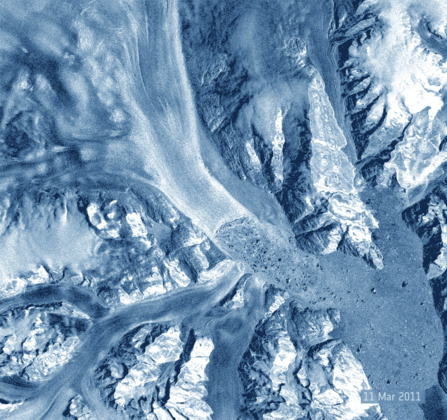
Cryo2ice turns five
In July 2020, CryoSat’s orbit was adjusted so that the ground tracks of both CryoSat and ICESat-2 satellites would converge over the Arctic, in a unique collaboration known as Cryo2ice.
The two satellites monitor areas of the globe beyond the reach of any other ice-monitoring missions, up to 88 degrees North and South. They give us critical information on the changing thickness of ice sheets and sea ice in the polar regions, as well as sea levels.
In 2024, the Cryo2ice campaign entered its fifth year of operation, continuing its objective to deliver crucial information on the evolving thickness of sea ice, and in February 2025, the orbits of the two satellites will be almost simultaneous.
Last but not least – an unexpected application for SMOS
In October – just weeks before the mission’s 15th anniversary science conference – we featured a surprising application for SMOS, in which the satellite was used to monitor the conditions within caves containing prehistoric artworks.
The research published in Scientific Reports drew on data from ESA’s SMOS mission and other Earth observing satellites, to better understand changes to the microclimate of the Altamira caves in Northern Spain, and how this could affect the artefacts they contain over the next decades.
As part of the case study, researchers developed a modelling approach to predict annual fluctuations of carbon dioxide levels within the caves, representing the first time such a methodology was employed for this application.