Featured
About SPOT 6
SPOT 6 (Satellite pour l'Observation de la Terre) is a commercial Earth-imaging satellite owned and operated by Airbus Defence and Space. It was launched on 9 September 2012 and remains operational.
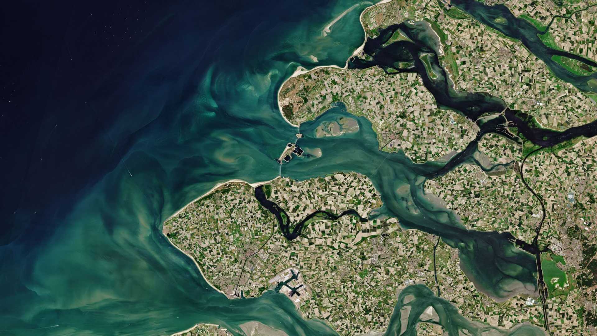
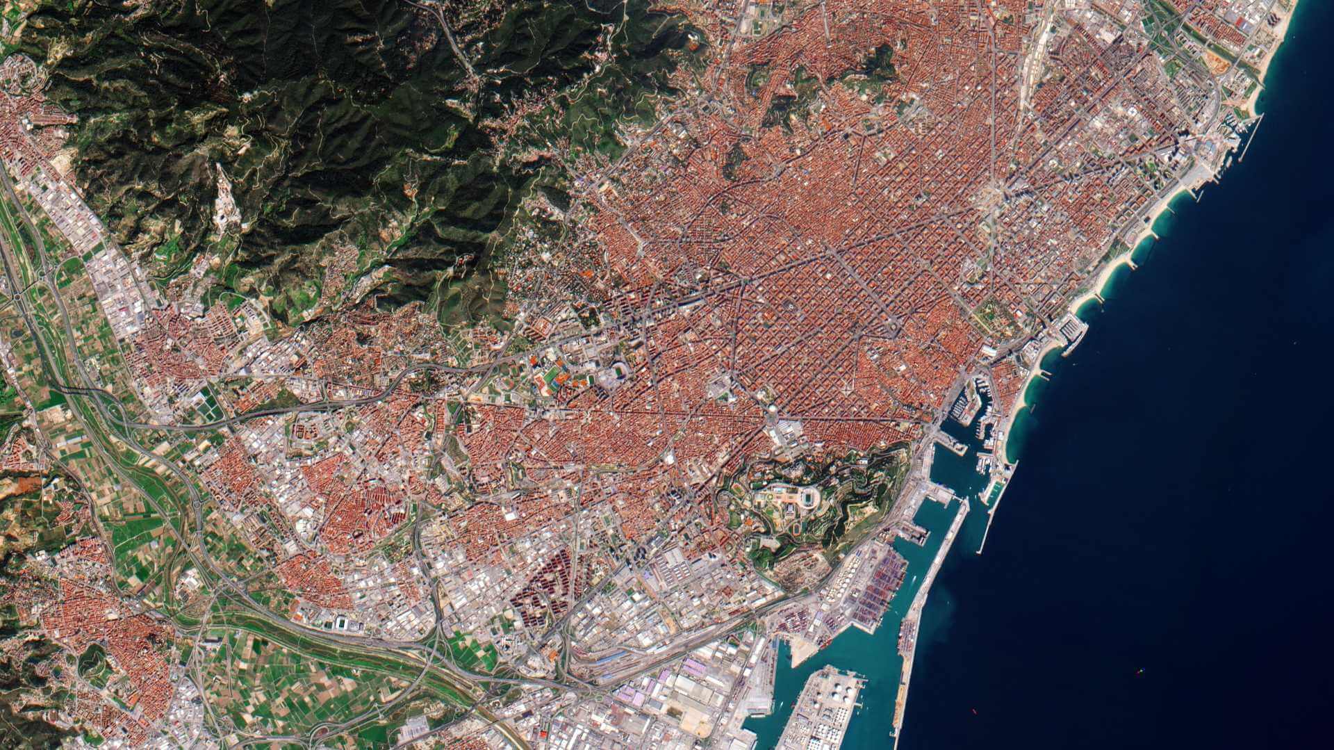
SPOT 6 and SPOT 7 identical satellites, form a constellation designed to provide continuity of high-resolution, wide-swath SPOT data up to 2023. Both satellites have drawn on technological and operational innovations conceived for the Pléiades constellation. It represents a source of broad-swath imagery in complement to the Pléiades Very High Resolution data. Users have access to 1.5-m colour imagery, to high quality ortho-images and to large area mosaics.
| Orbit Height | 694 km |
| Orbit Type | Sun-synchronous |
| Orbit Inclination | 98.2° |
| Local Equator Crossing Time | 10:00 AM at descending node |
| Orbit Duration | 98.79 minutes |
| Repeat Cycle | 26 days |
| Revisit Capability |
|
SPOT 6 is part of ESA's Third Party Missions Programme, in which ESA has an agreement with Airbus Defence and Space to distribute data products from the mission.
SPOT 6 Objectives
SPOT 6, like all the SPOT missions, is aimed at supplying high-resolution, wide-area optical imagery. This was designed to improve the knowledge and management of Earth's resources, detecting and forecasting phenomena involving climatology and oceanography, and monitoring human activities and natural phenomena.
SPOT 6 Instruments
New Astrosat Optical Modular Instrument (NAOMI)
Two identical NAOMI instruments on board SPOT 6 provide data up to 1.5 m spatial resolution panchromatic and multispectral. They are able to operate both in two modes, either simultaneously or individually. In simultaneous mode the swath is 120 km2 and individual mode the swath is 60 km2.
| Type | High-resolution optical pushbroom imager | |
| Ground Sample Distance |
| |
| Swath Width | 60 km | |
| Field of Regard | ±30° (spacecraft tilting capability about nadir for event monitoring) | |
| Bands | PAN | 0.45-0.75 µm |
| Blue | 0.45-0.52 µm | |
| Green | 0.53-060 µm | |
| Red | 0.62-0.69 µm | |
| NIR (Near Infrared) | 0.76-0.89 µm | |
SPOT 6 Data
DATA COLLECTIONS
ESA is offering access to the full SPOT 6 archive for scientific research and application development. Access is only available to submitted proposals that are accepted.
As many as possible of the high-quality and innovative proposals submitted will be supported within the quota limit available, therefore, only a limited amount of products can be made available to each project.
ESA offers registered users access through the Online Dissemination server to the SPOT 6 and 7 ESA archive. The dataset consists of coverage that ESA has collected during this mission and the dataset continues to grow as new products are added.