Featured
About SPOT 4
SPOT 4 (Satellite pour l'Observation de la Terre) was a commercial Earth-imaging satellite from CNES (Centre National D’Etudes Spatiales), the French Space Agency. It was launched on 24 March 1998 and ceased operations after a malfunction on 29 June 2013.
| Orbit Height | 832 km |
| Orbit Type | Sun-synchronous circular |
| Orbit Inclination | 98.7° |
| Orbit Duration | 101 mins |
| Repeat Cycle | 26 days |
SPOT 4 Objectives
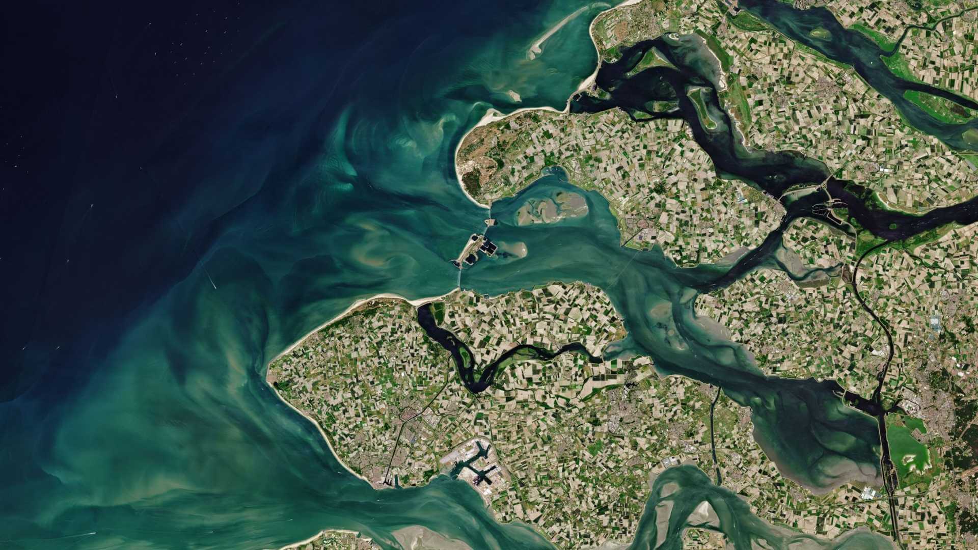
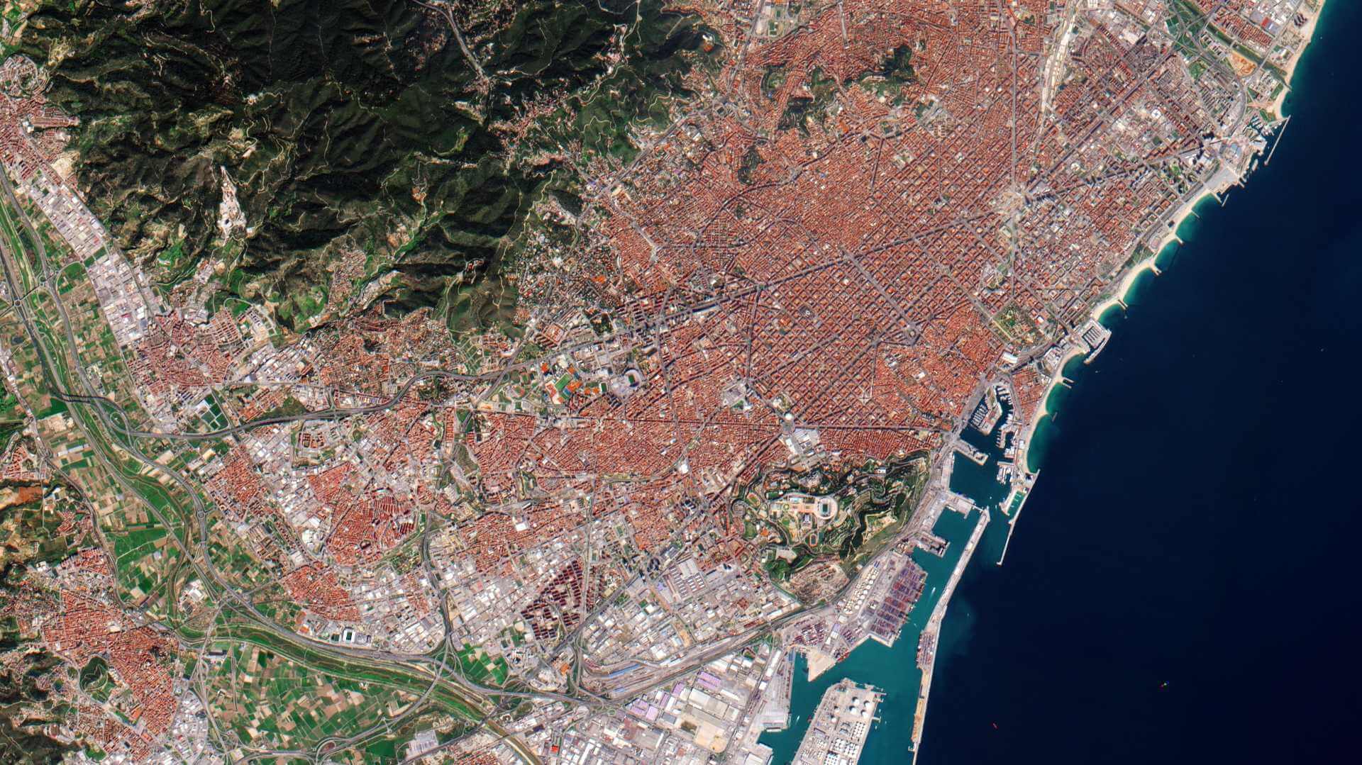
SPOT 4, like all the SPOT missions, was aimed at supplying high-resolution, wide-area optical imagery. This was designed to improve the knowledge and management of Earth's resources, detecting and forecasting phenomena involving climatology and oceanography, and monitoring human activities and natural phenomena.
SPOT 4 Instruments
High-Resolution Visible and InfraRed (HRVIR)
With respect to the HRV instrument on board SPOT 1, 2 and 3 the HRVIR had the same geometric imaging characteristics but improved performance was achieved by adding a new shortwave infrared spectral band (SWIR).
Two identical HRVIR imaging instruments on SPOT 4 were able to operate in two modes either simultaneously or individually.
The HRVIR had an oblique viewing capability of 27° on each side of the local vertical. The swath was 117 km2 if both sensors were used simultaneously with a 3 km2 overlap.
| Type | High-resolution optical pushbroom imager | |
| Ground Sample Distance | Panchromatic: 10 m Multispectral: 20 m | |
| Swath Width | 60 km | |
| Bands | Monospectral (PAN) Green Red NIR (Near Infrared) SWIR | 0.61-0.68 µm 0.50-0.59 µm 0.61-0.68 µm 0.79-0.89 µm 1.53 - 1.75 µm |
| Instrument Field of View | 4.13° | |
| Ground Sampling Interval (Nadir Viewing) | Panchromatic: 10 m x 10 m Multispectral: 20 m x 20 m | |
| Pixel per Line | Panchromatic: 6000 Multispectral: 3000 | |
| Swath Width | 60 km | |
Other Instruments
The VEGETATION instrument was carried on SPOT 4 and onward. It acts independently of the HRVIR (Visible & Infrared High-Resolution) sensors. This instrument can cover almost all Earth’s surface in a day because of its swath size of 2250 km. It captures reflected light in four spectral bands (blue, red, near-infrared, and middle-infrared).
SPOT 4 Data
DATA COLLECTIONS
Registered users are allowed access to the SPOT 1 to 5 ESA archive through the online dissemination server. The archive consists mainly of imagery over Europe and Africa that ESA has collected through the years.