Featured
About IRS-R2
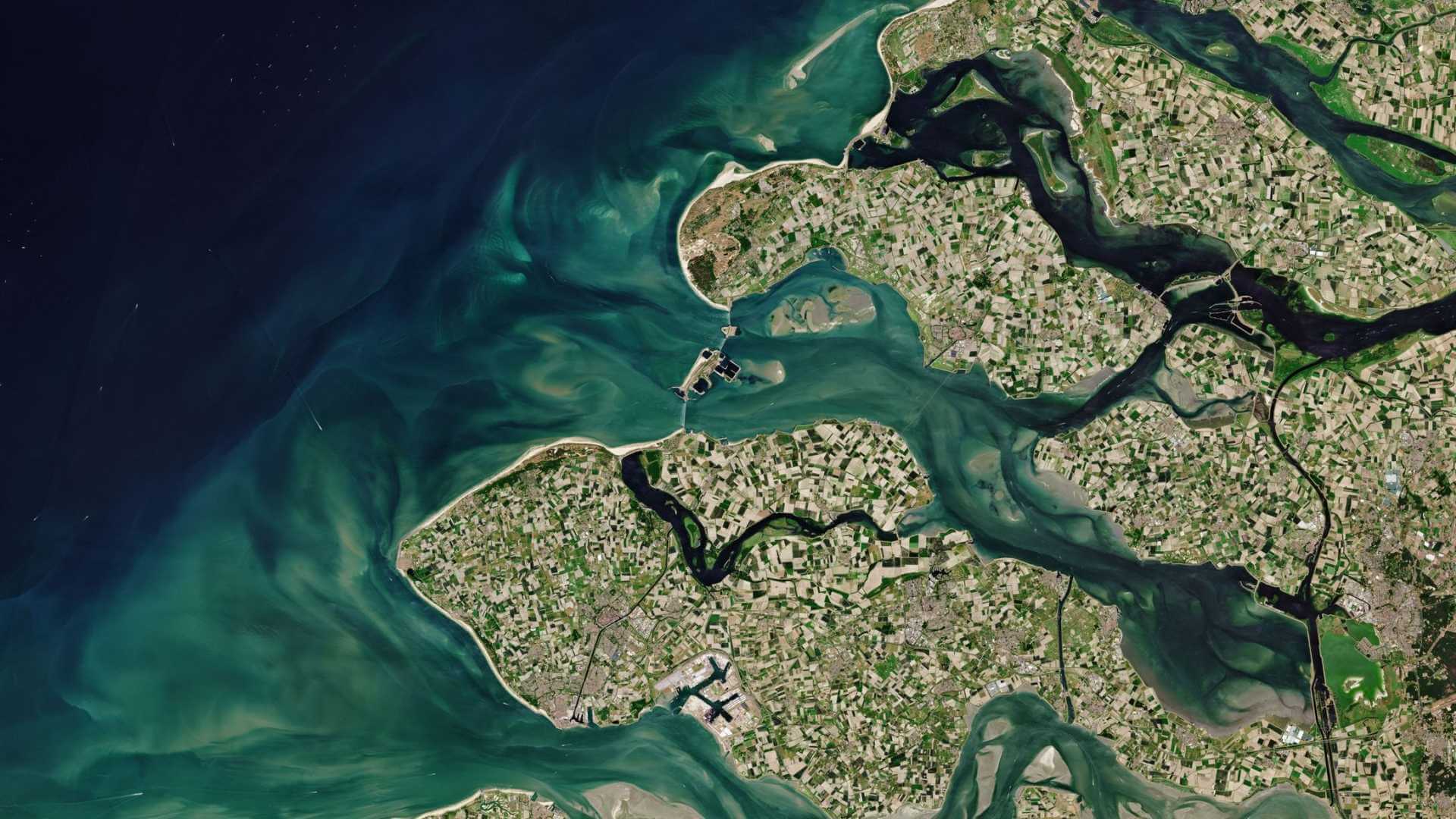
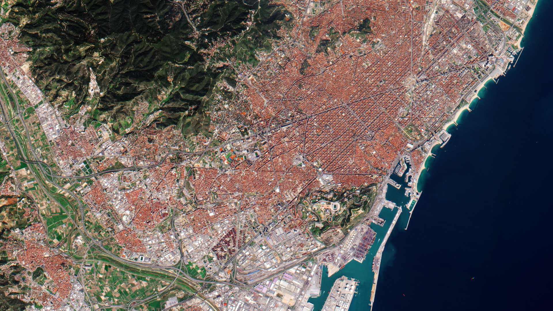
IRS-R2 (ResourceSat-2) is an environmental satellite from the Indian Space Research Organisation (ISRO) which launched on 20 April 2011 and remains operational. It is the eighteenth remote sensing satellite built by ISRO.
| Orbit | Circular Polar Sun Synchronous |
| Orbit Altitude | 822 km + 20 km (3 Sigma) |
| Orbit Inclination | 98.731º + 0.2º |
| Orbit Period | 101.35 min |
| Number of Orbits per day | 14 |
| Local Time of Equator crossing | 10:30 am |
| Repetivity | 24 days |
IRS-R2 Objectives
The overall objectives of the ResourceSat-2 mission are to provide continued remote sensing data services on an operational basis for integrated land and water resources management.
IRS-R2 Instruments
Linear Imaging Self-Scanning Sensor-III (LISS-3)
LISS-III operates in three spectral bands in VNIR and one in Short Wave Infrared (SWIR) band with 23.5 metre spatial resolution. There was improved radiometric accuracy from 7 bits to 10 bits for LISS-III and LISS-IV.
| Parameter/Instrument | LISS-3 |
| Spatial resolution or IFOV (Instantaneous Field of View) | 23.5 m |
| Spectral bands (µm) | B2: 0.52-0.59, (green) B3: 0.62-0.68, (red) B4: 0.77-0.86, (NIR) B5: 1.55-1.70 (SWIR) |
| Swath width | 141 km |
| Detector line arrays x No of elements | 4 x 6,000 |
| Data quantization | 10 bit (VNIR) 10 bit (SWIR) |
| Square wave response at Nyquist | B2> 0.40, B3> 0.40 B4> 0.35, B5> 0.20 |
| Power consumption | 70 W |
| Instrument mass | 106.1 kg |
| Date rate | 52.5 Mbit/s |
Linear Imaging Self-Scanning Sensor-IV (LISS-4)
LISS-IV operates in three spectral bands in the visible and Near Infrared Region (VNIR) with 5.8 metre spatial resolution and steerable up to 26 degrees across track to obtain stereoscopic imagery and achieve five-day revisit capability. The LISS-IV multispectral swath was improved from 23 km to 70 km.
| Parameter/Instrument | LISS-4 |
| Spatial resolution or IFOV (Instantaneous Field of View) | = 5.8 m |
| Spectral bands (µm) | B2: 0.52-0.59, (green) B3: 0.62-0.68, (red) B4: 0.77-0.86 (NIR) B3-default band for mono |
| Swath width | 70 Km in Mono Mode, 23.9 km in MX Mode |
| Detector line arrays x No of elements | 1 x 12,288 PAN mode 3 x 12,288 MS mode |
| Data quantization | 10 bit |
| Square wave response at Nyquist | > 20 |
| Power consumption | 216 W |
| Instrument mass | 169.5 kg |
| Date rate | 105 Mbit/s |
Advanced Wide Field Sensor (AWiFS)
The AWiFS operates in three spectral bands in VNIR and one band in SWIR with 56 metre spatial resolution. There was improved radiometric accuracy from 10 bits to 12 bits for AWIFS.
| Parameter/Instrument | AWiFS |
| Spatial resolution or IFOV (Instantaneous Field of View) | 56 m (nadir) (70 m a swath edge) |
| Spectral bands (µm) | B2: 0.52-0.59, (green) B3: 0.62-0.68, (red) B4: 0.77-0.86, (NIR) B5: 1.55-1.70 (SWIR) |
| Swath width | 740 km |
| Detector line arrays x No of elements | 4 x 2 x 6,000 |
| Data quantization | 10 bit |
| Square wave response at Nyquist | B2> 0.40, B3> 0.40 B4> 0.35, B5> 0.20 |
| Power consumption | 114 W |
| Instrument mass | 103.6 kg |
| Date rate | 52.5 Mbit/s |
Non-scientific measuring instruments
The satellite also carries a Canadian instrument known as AIS (Automatic Identification System) - as an experimental payload for ship surveillance in VHF band to derive position, speed and other information about ships.
IRS-R2 Data
DATA COLLECTIONS
ESA is offering, for scientific research and application development, access to archive and new tasking data from ResourceSat-2 data upon submission and acceptance of a project proposal. These products are available as part of the GAF Indian Satellite Imagery products.
ESA will support as many high-quality and innovative projects as possible within the quota limit available, therefore only a limited amount of products can be made available to each project.
Following collection is available: