- Learn & Discover
- How satellite data empower sustainable urban growth
- Analysing train track construc...
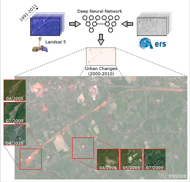
Analysing train track construction in Liège
25 May 2023

Title: Analysing train track construction in Liège
Description: This figure shows a train track construction near the city of Liège, in the period 2000 to 2010. Top: Deep-temporal optical and SAR observations (30 and 12.5 m/pixel) were fed into the Deep Neural Network (DNN), which provided detected urban changes (in red). Bottom: very high resolution imagery from Google Earth (< 1 m/pixel), used for visualisation purposes only, with detected urban changes superimposed in red and clearly visible construction hotspots in 2005, 2009 and 2015.
Copyright: Landsat-5 TM courtesy of the U.S. Geological Survey; ERS-1/2 data provided by ESA; Google Earth ™ © 2021 Maxar Technologies.