- Data
- GOCE Global Gravity Field Mode...
GOCE Global Gravity Field Models and Grids
Navigate To
How to Access Data
EO Sign In Authentication (Open)
Access via HTTPS
- Go to the Dissemination Service
- Find the product you want
- Register or log in to EO Sign In
- Download.
Access via FTP
- Open ftps://goce-ds.eo.esa.int/ via an FTP client, using implicit FTP over TLS
- Log in with an active EO Sign In account
- Find the product you want
- Download.
All products are freely accessible in accordance with ESA’s Earth observation data policy. An active EO Sign In account is required to download the products.
New users can register an account on EO Sign In. For further information about the EO Sign In Service you can visit TellUs.
ESA internal users cannot use their ESAAD account.
Should you need support to access the data, please contact EOHelp.
Available to Residents of the Following Countries
Collection Description
This collection contains gravity gradient and gravity anomalies grids at ground level and at satellite height. In addition it contains the GOCE gravity field models (EGM_GOC_2, EGM_GCF_2) and their covariance matrices (EGM_GVC_2):
GOCE Gravity solution GRIDS
Gridded Gravity gradients and anomalies at ground level:
- GO_CONS_GRC_SPW_2__20091101T000000_20111231T235959_0001.TGZ
- GO_CONS_GRC_SPW_2__20091101T055147_20120731T222822_0001.TGZ
- GO_CONS_GRC_SPW_2__20091101T055226_20131020T033415_0002.TGZ
- GO_CONS_GRC_SPW_2__20091009T000000_20131021T000000_0201.TGZ.
Latest baseline is: GO_CONS_GRC_SPW_2__20091009T000000_20131021T000000_0201.TGZ.
Gridded Gravity gradients and anomalies at satellite height:
- GO_CONS_GRD_SPW_2__20091101T055147_20100630T180254_0001.TGZ
- GO_CONS_GRD_SPW_2__20091101T055147_20120731T222822_0001.TGZ
- GO_CONS_GRD_SPW_2__20091101T055226_20131020T033415_0002.TGZ
- GO_CONS_GRD_SPW_2__20091009T000000_20131021T000000_0201.TGZ.
Latest baseline is: GO_CONS_GRD_SPW_2__20091009T000000_20131021T000000_0201.TGZ.
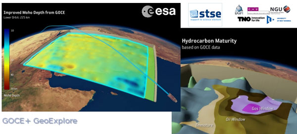
As output from the ESA-funded GOCE+ GeoExplore project, GOCE gravity gradients were combined with heterogeneous other satellite gravity information to derive a combined set of gravity gradients complementing (near)-surface data sets spanning all together scales from global down to 5 km. The data is useful for various geophysical applications and demonstrate their utility to complement additional data sources (e.g., magnetic, seismic) to enhance geophysical modelling and exploration.
The GOCE+ GeoExplore project is funded by ESA through the Support To Science Element (STSE) and was undertaken as a collaboration of the Deutsches Geodätisches Forschungsinstitut (DGFI), Munich, DE, the Christian-Albrechts-Universität zu Kiel, the Geological Survey of Norway (NGU), Trondheim, Norway, TNO, the Netherlands and the University of West Bohemia, Plzen, CZ.
Read more about gravity gradients and how GOCE delivered them in this Nature article: Satellite gravity gradient grids for geophysics.
View images of the GOCE original gravity gradients and gradients with topographic reduction grids.
| GRIDS | |
| File Type | Gridded data: full Gravity Gradients, at 225 km and 255 km with and without topographic correction |
| GGG_225 | Computed from GOCE/GRACE gradients lower orbit phase February 2010 - October 2013 |
| GGG_255 | Computed from GOCE/GRACE gradients nominal orbit phase February 2010 - October 2013 |
| TGG_225 | Gravity gradient grids from topography at fixed height of 225/255 km above ellipsoid given in LNOF (Local North Oriented Frame) |
| TGG_225 | Gravity gradient grids from topography at fixed height of 225/255 km above ellipsoid given in LNOF (Local North Oriented Frame) |
| MAPS | |
| File Type | Maps of Gravity Gradients with and without topographic corrections |
| Vij_225km_Patch_n.jpg | Maps of grids from lower orbit phase with and without topographic correction from ETOPO1 |
| Along-orbit | |
| File Type | Full Gravity Gradients, along-orbit, in GRF and TRF reference frames. A detailed description is provided in the data set user manual |
| GGC_GRF | Combined gradients from GRACE (long wavelengths) & GOCE (measurement band) in the GRF (Gradiometer Reference Frame) |
| GGC_TRF | Combined gradients from GRACE (long wavelengths) & GOCE (measurement band) rotated from GRF to TRF (Terrestrial Reference Frame: North, West, Up) |
Direct solution
First Generation
- Product:
- GO_CONS_EGM_GOC_2__20091101T000000_20100110T235959_0002.TGZ
- Variance/Covariance matrix:
- GO_CONS_EGM_GVC_2__20091101T000000_20100110T235959_0002.TGZ
Second Generation
- Product:
- GO_CONS_EGM_GOC_2__20091101T000000_20100630T235959_0002.TGZ
- Variance/Covariance matrix:
- GO_CONS_EGM_GVC_2__20091101T000000_20100630T235959_0001.TGZ
Third Generation
- Product:
- GO_CONS_EGM_GOC_2__20091101T000000_20110419T235959_0001.TGZ
- Variance/Covariance matrix:
- GO_CONS_EGM_GVC_2__20091101T000000_20110419T235959_0001.TGZ
- Coefficients (ICGEM format):
Fourth Generation
- Product:
- GO_CONS_EGM_GOC_2__20091101T000000_20120801T060000_0001.TGZ
- Variance/Covariance matrix:
- GO_CONS_EGM_GVC_2__20091101T000000_20120801T060000_0002.TGZ
Fifth Generation
- Product:
- GO_CONS_EGM_GOC_2__20091101T000000_20131020T235959_0002.TG
- Variance/Covariance matrix:
- GO_CONS_EGM_GVC_2__20091101T000000_20131020T235959_0001.TGZ
- Coefficients (ICGEM format):
Sixth Generation
- Product:
- GO_CONS_EGM_GOC_2__20091009T000000_20131020T235959_0201.TGZ
- Variance/Covariance matrix:
- GO_CONS_EGM_GVC_2__20091009T000000_20131020T235959_0201.TGZ
- Coefficients (ICGEM format):
Release 6 gravity model validation report.
Time-Wise solution
First Generation
- Product:
- GO_CONS_EGM_GOC_2__20091101T000000_20100111T000000_0002.TGZ
- Variance/Covariance matrix:
- GO_CONS_EGM_GVC_2__20091101T000000_20100111T000000_0002.TGZ
Second Generation
- Product:
- GO_CONS_EGM_GOC_2__20091101T000000_20100705T235500_0002.TGZ
- Variance/Covariance matrix:
- GO_CONS_EGM_GVC_2__20091101T000000_20100705T235500_0001.TGZ
Third Generation
- Product:
- GO_CONS_EGM_GOC_2__20091101T000000_20110430T235959_0001.TGZ
- Variance/Covariance matrix:
- GO_CONS_EGM_GVC_2__20091101T000000_20110430T235959_0001.TGZ
- Coefficients (ICGEM format):
Fourth Generation
- Product:
- GO_CONS_EGM_GOC_2__20091101T000000_20120618T235959_0002.TGZ
- Variance/Covariance matrix:
- GO_CONS_EGM_GVC_2__20091101T000000_20120618T235959_0001.TGZ
Fifth Generation
- Product:
- GO_CONS_EGM_GOC_2__20091101T000000_20131021T000000_0002.TGZ
- Variance/Covariance matrix:
- GO_CONS_EGM_GVC_2__20091101T000000_20131021T000000_0001.TGZ
- Coefficients (ICGEM format):
Sixth Generation
- Product:
- GO_CONS_EGM_GOC_2__20091009T000000_20131021T000000_0201.TGZ
- Variance/Covariance matrix:
- GO_CONS_EGM_GVC_2__20091009T000000_20131021T000000_0202.TGZ
- Coefficients (ICGEM format):
- Combined gravity field GOCE model plus Antarctic and Arctic data (ICGEM format):
Download release 6 gravity model validation report.

Technical Details
DATA SET SPECIFICATIONS
- European Space Agency, 2010, GOCE Global Gravity Field Models and Grids Data Collection. Version 1.0.https://doi.org/10.5270/esa-8xb8scs
PROCESSING LEVEL
APPLICABLE TERMS & CONDITIONS
DATA CITATION
Having Problems Accessing Data?
Resources
Discover Latest Data
CIRFAEx
From 22 April 2022 to 12 May 2022, the Norwegian research vessel Kronprins Haakon served as base for in-situ measurements and observations o...
AVHRR L1B/1C Local Area Coverage Imagery
Level-1B This collection is composed of AVHRR L1B products (1.1 km) reprocessed from the NOAA POES and Metop AVHRR sensors data acquired at ...
Landsat 5 TM Europe and North Africa Coverage 1984-85
This collections contains Landsat 5 Thematic Mapper (TM) imagery acquired over Europe and North Africa from April 1984 to December 1985. The...
Landsat 5 TM Europe and North Africa Coverage 1986-89
This collections contains Landsat 5 Thematic Mapper (TM) imagery acquired over Europe and North Africa from January 1986 to November 1989. T...