- Learn & Discover
- ICEYE, the World’s First SAR N...
ICEYE, the World’s First SAR New Space Constellation
20 Dec 2021
ICEYE is a revolutionary Finnish company that developed and launched the world’s first under-100 kilogram synthetic-aperture radar (SAR) satellites into orbit.
Founded in 2014, by members of Aalto University's Department of Radio Science and Engineering, the company aims to build, launch and operate a constellation of over 18 SAR microsatellites, also known as New Space satellites.
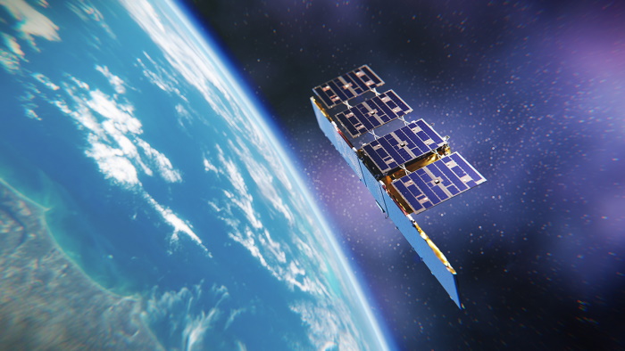
ICEYE-X1, the company’s initial proof-of-concept microsatellite mission was launched on 12 January 2018, and marked two global premieres: the first satellite under 100 kg to carry a synthetic-aperture radar and the first commercial Finnish satellite to be launched into orbit.
As of December 2021, they have successfully launched 14 satellites.
Innovative technology
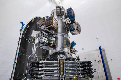
The company aims to facilitate the access to SAR data and unlock its potential. By building the largest SAR satellite constellation, ICEYE is able to provide persistent monitoring with valuable data up to multiple times per day.
Equipped with the newest SAR satellite technology, ICEYE satellites have innovative capabilities in SAR imaging. The constellation enables global imaging with SAR satellites more frequently than ever before, maintaining the same resolution class as traditional, commercial providers. In July, the company launched a next-generation demonstration mission, allowing new and innovative capabilities in SAR imaging, such as a factor two improvement in ground resolution, and the capability to simultaneously image and downlink data for near-immediate data delivery.
ICEYE’s SAR satellites are built in house in the company's premises in Espoo, Finland, including Commercial-Off-The-Shelf (COTS) components when suitable, enabling New Space cost-effectiveness and timeliness of development. Due to their SAR capabilities, they can see through clouds and darkness and collect data regardless of weather conditions and time of day.
The satellites are designed to provide reliable imagery with a very short revisit time to enable the detection and tracking of rapid changes on Earth’s surface. ICEYE data can be used for a wide variety of cases, such as monitoring changing sea ice for maritime and environmental uses, iceberg and flood monitoring and tracking marine oil spills.
A closer look at ICEYE’s imaging modes
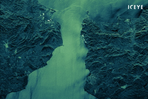
ICEYE SAR satellites operate with side-looking X-band SAR sensors that use active phased array antenna technology. They are both right and left-looking and capable of acquiring satellite imagery of Earth using three imaging modes: Spot, Strip and Scan. With this multimode capability, ICEYE enables monitoring of wide-areas up to 10,000 km2 with a single image, and resolution up to 25 cm for detailed change detection.
In Spot mode, antenna steering in the azimuth direction is used to increase the illumination time, resulting in a larger synthetic-aperture and, therefore, better azimuth resolution compared to a continuous Strip mode. Depending on needs, Spot can be acquired with a scene size up to 15 km x 15 km, with 1 m resolution or 5 km x 5 km with 25 cm resolution. This mode is designed for frequent change detection and detailed monitoring of objects.
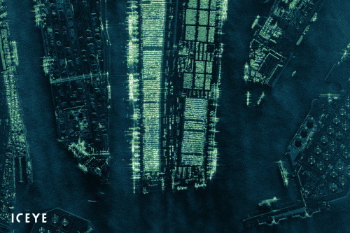
In Strip mode, the ground swath is illuminated with a continuous sequence of pulses, while the antenna beam is fixed in elevation and azimuth. This results in an image strip with a continuous image quality in the flight direction. Strip mode is perfect for detecting changes to vast sea and land areas. It is suited to see and respond to natural disasters, illegal activities, and for persistently monitoring borders, coastal areas or any location of interest. It provides 3 m resolution and 30 km x 50 km scene size, which can be extended to 600 km in increments of 50 km.
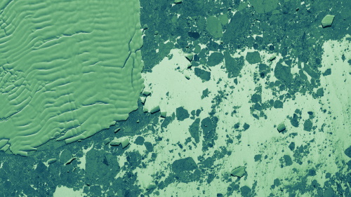
In Scan mode, due to ICEYE’s flat, phased array antenna design, the image is collected by electrically steering the radar beam in elevation and azimuth. This mode covers an area up to 100 km x 100 km with 15 m resolution. Scan mode is particularly effective for acquiring wide coverage imagery for maritime use cases, enabling coast-to-coast monitoring of sea routes.
Integration as ESA Third Party Mission
On 10 June 2021, ESA's Earth Observation Programme Board approved the integration of ICEYE as a Third Party Mission (TPM) full member, within the framework of ESA’s Earthnet Programme, giving scientific researchers and pre-operational Earth Observation-based application developers free access to ICEYE’s SAR data.
The TPM Programme has existed for over four decades and has established a global collaboration between space agencies, and mission and data providers for the benefit of the Earth Observation community. ICEYE data were extensively and successfully validated during previous programme stages under Earthnet’s Data Assessment framework before becoming part of the TPM portfolio.
All of ICEYE’s imaging modes are offered through the TPM Programme. Eligible users can get access to the very high-resolution Spot imaging mode covering areas of 25 km2, the high-resolution Strip and the Scan imaging mode covering areas of 10,000 km2.