- All Categories (13)
- Data (1)
- News (1)
- Events (2)
- Tools (3)
- Documents (6)
News - Infographics
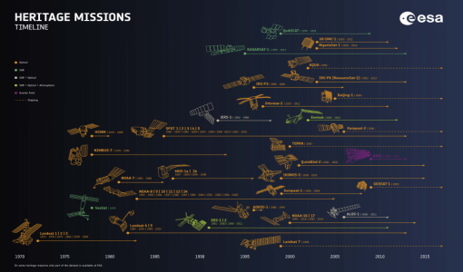
Timeline to over 40 years of historical satellite missions
ESA's Heritage Space Programme preserves historical data from over 40 years of Earth observation missions.
Event - Workshop
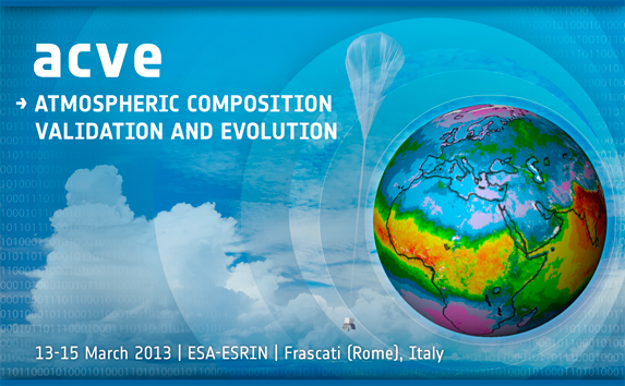
ACVE: Atmospheric Composition Validation and Evolution workshop
ACVE: Atmospheric Composition Validation and Evolution workshop
Tools - Visualisation
EVDC Orbit Prediction Tool
The EVDC Orbit Prediction and Overpass Tool generates and visualises satellite's overpasses.
Data - External Data (Restrained)

ADAM Surface Reflectance Database v4.0
ADAM enables generating typical monthly variations of the global Earth surface reflectance at 0.1° spatial resolution (Plate Carree projection) and over the spectral range 240-4000 nm. The ADAM product is made of gridded monthly mean climatologies over land and ocean surfaces, and of a companion API toolkit that enables the calculation of hyperspectral (at 1 nm resolution over the whole 240-4000 nm spectral range) and multidirectional reflectances (i.e. in any illumination/viewing geometry) depending on user choices. The ADAM climatologies that feed the ADAM calculation tools are: For ocean: Monthly chlorophyll concentration derived from SeaWiFS-OrbView-2 (1999-2009); it is used to compute the water column reflectance (which shows large spectral variations in the visible, but is insignificant in the near and mid infrared). Monthly wind speed derived from SeaWinds-QuikSCAT-(1999-2009); it is used to calculate the ocean glint reflectance. For land: Monthly normalized surface reflectances in the 7 MODIS narrow spectral bands derived from FondsdeSol processing chain of MOD09A1 products (derived from Aqua and Terra observations), on which relies the modelling of the hyperspectral/multidirectional surface (soil/vegetation/snow) reflectance. Uncertainty variance-covariance matrix for the 7 spectral bands associated to the normalized surface reflectance. For sea-ice: Sea ice pixels (masked in the original MOD09A1 products) have been accounted for by a gap-filling approach relying on the spatial-temporal distribution of sea ice coverage provided by the CryoClim climatology for year 2005.
Document - Data Access Information

Access-to-ESA-Earth-Observation-Data-Quick-Guide.pdf
How to Access ESA Earth Observation Data - a Quick Guide
Tools - Analysis
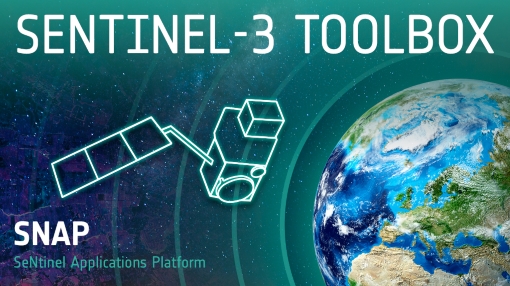
Sentinel-3 Toolbox
The Toolbox consists of a set of visualisation, analysis and processing tools for the exploitation of OLCI and SLSTR data.
Tools - Analysis
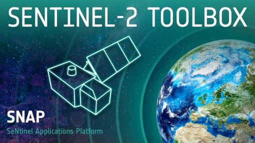
Sentinel-2 Toolbox
The Toolbox consists of a rich set of visualisation, analysis and processing tools for the exploitation of optical high-resolution products including the Sentinel-2 MSI sensor.
Document - Algorithms Theoretical Baseline Document

cawa-requirements-baseline.pdf
CAWA (Advanced Clouds, Aerosols and WAter vapour products for Sentinel-3/OLCI) requirements baseline document provides information about the physical background, technical structure and the functional principle of the CAWA total column water vapour retrieval as defined within the CAWA project, which aims to the development and improvement of advanced atmospheric retrieval algorithms for the Envisat/MERIS and Sentinel-3/OLCI mission.
Event - Workshop

CEOS-IVOS Workshop on Inter-comparison of Large Scale Optical and Infrared Sensors
The 2004 workshop was an opportunity to present and exchange experiences and knowledge from work on inter-comparing large scale optical sensors at different product levels.
Document - Algorithms Theoretical Baseline Document
cawa-algorithm-theoretical-basis-cloud-top-pressure.pdf
This CAWA (advanced Clouds, Aerosols and WAter vapour products for Sentinel-3/OLCI) project document provides information about the physical background, technical structure and the functional principle of the CAWA cloud top pressure retrieval as defined by SEOM CAWA project.
Document - Proceedings

EO-Summer-School-4-An-introduction-to-marine-optics-and-ocean-colour-products-algorithms.pdf
This presentation from ESA's EO Summer School 4 is an introduction to marine optics and ocean colour products & algorithms
Document - Proceedings
EO-Summer-School-4-Understanding-biological-variability-in-the-open-ocean-GLOBCOLOUR-project.pdf
This presentation from ESA's EO Summer School 4 describes GLOBCOLOUR project
Document - Proceedings
EO-Summer-School-5-Satellite-climatology-and-GCOS.pdf
This presentation from ESA's EO Summer School 5 describes Satellite climatology and Global Climate Observing System (GCOS)