- News
- SAOCOM the Argentinean constel...
SAOCOM the Argentinean constellation with an Italian twist
11 Feb 2022
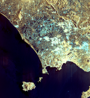
The SAOCOM (Argentinean Microwave Observation Satellites) were developed to satisfy user needs in Argentina, demanded by society and economic and productive sectors, as well as by the National Space Programme.
The main mission goals consist of supporting agriculture, hydrology—including floods and other emergencies— to generate operative soil moisture maps; and to exploit SAR interferometric capability.
Although the main objectives of SAOCOM were to satisfy Argentinean needs, an Italian-Argentine agreement has allowed access to data in the European and Mediterranean basin.
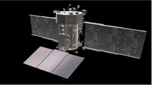
SAOCOM is a joint project of CONAE and ASI (Italian Space Agency). To this effect, an agreement called SIASGE (Italian-Argentine System of Satellites for Emergency Management) has been signed under which the satellites in the Argentinian SAOCOM system will operate jointly with the Italian COSMO-SkyMed constellation in X-band, to provide frequent information relevant for emergency management.
This approach of a two SAOCOM and a four COSMO-SkyMed spacecraft configuration offers an effective means of a twice-daily coverage capability. By joining forces, both agencies will be able to generate SAR products in X-band and in L-band for their customers
With a mission lifetime of five years, a revisit time of 16 days (with 1 satellite) and 8 days (with the constellation) and a world-wide coverage, SAOCOM’s requirements include providing timely information in support of natural and anthropogenic disaster management (such as regional flooding, volcanic eruptions, earthquakes, landslides, forest fires, etc.); conducting monitoring services for agriculture, mining and ocean applications - including monitoring surveys of Antarctica (study of continental glacier evolution, global change indicators, etc.)
The goal is to obtain data with high-quality radiometric and geometric accuracy (for instance, natural resources identification, interferometry, glaciology), and to provide also high revisit frequencies (daily) in support of specific operational requirements.
In the Pampas region in Argentina, SAOCOM acquired fixed and planned images, featuring the soil moisture level, thus helping farmers with their estimation of different yield scenarios.
For these reasons, SAOCOM currently represents a valuable asset for Argentina, Italy and for all the worldwide users who can benefit from its excellent data.