- News
- How GEOSAT helps to unlock the...
How GEOSAT helps to unlock the potential of Earth observation data
24 Feb 2022
High-resolution imagery delivered by a privately-owned system of European satellites is facilitating international efforts to boost prosperity, protect the environment, and tackle urgent global challenges.
The GEOSAT Earth observation series consists of two missions that work in tandem to generate detailed environmental insights that are guiding decision-making in several key areas of the global economy.
These data are being distributed by ESA as part of its Third Party Missions Programme, an initiative that fosters international collaborations to promote the delivery of free and accessible information about Earth’s environment.
An innovative system
The series’ initial mission, GEOSAT-1, was the first privately-owned European satellite to be sent to space. It launched on 29 July 2009, from the Baikonur Cosmodrome, in Kazakhstan, and remains operational.
Five years later – on 19 June 2014 – the second satellite in the series, GEOSAT-2, was lofted into orbit from the Yasny Cosmodrome, in Russia. It was the first European satellite owned by a private company capable of providing sub-metric multispectral imagery worldwide.
Originally built for Elecnor Deimos in Spain, both missions are now owned and operated by geoinformation firm GEOSAT.
Revealing rapid changes
The missions work in tandem to provide total global coverage and high-frequency revisit capabilities, so that rapid environmental changes can be monitored anywhere on Earth.
GEOSAT-1 delivers medium-resolution images and a very wide swath, which enables it to capture huge areas of the planet’s surface very frequently.
GEOSAT-1 hosts a Multi-Spectral Camera, which operates in green, red and near-infrared spectra, has a resolution of 22 m, and a swath of 650 km.
GEOSAT-2 – which can cover up to 150,000 km2 per day, with a two-day average revisit time worldwide – complements these data by hosting a High-Resolution Advanced Imaging System (HiRAIS) that provides 75 cm per pixel images with a 12 km swath.
HiRAIS is a pan-sharpened multispectral optical instrument with a very-high resolution camera that observes five spectral channels – one panchromatic and four multispectral.
GEOSAT-2 also offers a Super Resolution product based on artificial intelligence, with resolutions of up to 40 cm. The techniques applied increase the image resolution and detail without losing quality. Artificial intelligence fills and smooths out irregularities much better than any other type of resampling, which increases the number of applications derived from the imagery generated.
Guiding sustainable growth
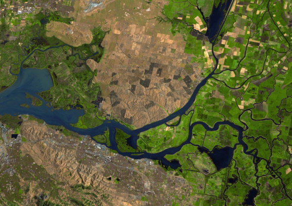
The insights delivered by the GEOSAT series are helping businesses in several areas of the global economy adapt to the rapid changes impacting the planet.
Crop growth, for example, is a product of environmental conditions – and GEOSAT is providing data that are helping farmers take a more precise approach to agriculture, boosting yields and reducing the impact of natural resources.
GEOSAT is a long-term provider of imagery to the US Department of Agriculture, with its Earth observation system capturing the entire surface of the US during the growing season.
Accurate cloud-free wall-to-wall coverage over the US is collected and delivered every 14 days, revealing how different crops across the country are growing. In addition, multi-spectral imaging is used to monitor how well plants absorb infrared radiation, which can reveal how much chlorophyll they contain – this is a key indicator of plant health.
The insights delivered by the GEOSAT series help to generate layered maps that enable farmers to sustainably maximise crop production worldwide.
Building resilience
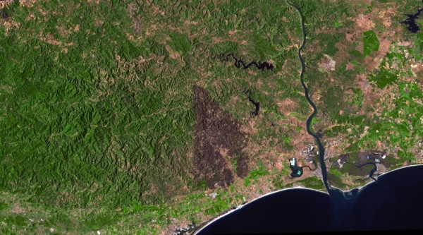
As extreme weather events increase in frequency and severity due to the impacts of climate change, GEOSAT has a key role in helping the international community accelerate crisis management efforts.
In July and August 2021, parts of Canada, Turkey, Portugal, Spain and Italy were swept by wildfires that threatened human life and vital infrastructure.
Using its tandem satellite system, GEOSAT generated high-resolution maps that detailed how the fires were spreading, enabling decision-makers to identify communities under threat.
In addition, GEOSAT activated its Emergency Service to monitor wildfires in Castro Marim in south Portugal. Near real-time imagery with a resolution of 75 cm was delivered to crisis management workers within 40 minutes after collection, enabling them to act rapidly to protect life and property.
GEOSAT also monitored the Palma volcano eruption in late 2021, delivering timely and accurate information about the evolution of the lava, and how infrastructure was affected or destroyed.
GEOSAT delivers data to support many other areas of the economy, including oil and gas, defence and security, land administration and mapping, the maritime sector and many more.
The GEOSAT data archive is available to a range of stakeholders via ESA’s Third Party Missions programme.