- All Categories (67118)
- Data (282)
- News (715)
- Missions (84)
- Events (206)
- Tools (61)
- Activities (77)
- Campaigns (106)
- Documents (65587)
TOOLS & TOOLBOXES
Find the tools you need to visualise, analyse and process the European Space Agency's Earth observation data.
Tools - Catalogues
21 Mar 2024CS2EO
CS2EO is a data catalogue that allows users to easily and quickly combine and download airborne and spaceborne altimetry data from CryoSat-2, ICESat-2, CryoVEx, IceBridge and CryoTEMPO-EOLIS.
Tools - Visualisation
31 Jan 2024PROBA-V Mission Exploitation Platform (MEP)
The MEP PROBA-V addresses a broad vegetation user community with the final aim to ease and increase the use of PROBA-V data by any user.
Tools - Apps
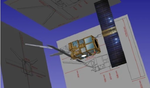
18 Dec 2023Earth Online Visuals
The Earth Online Visuals app displays interactive 3D models of ESA’s Earth Explorers and the Envisat and GOCE Heritage satellites. The models detail the mission payloads and where the instruments are placed on the satellites.
Tools - Catalogues
21 Nov 2023Copernicus Data Space Ecosystem
The Copernicus Data Space Ecosystem provides free instant access to a wide range of data and services from the Copernicus Sentinel missions.
Tools - Catalogues
 21 Oct 2022
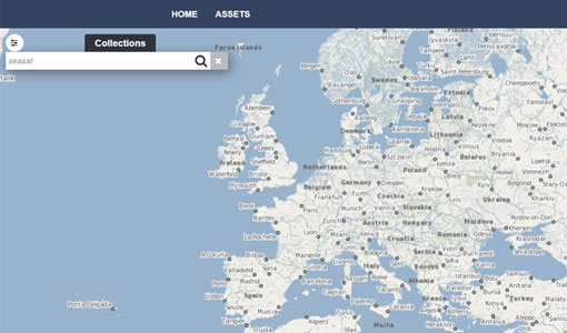
FedEO
FedEO is a data catalogue that provides a unique entry point to a number of scientific catalogues and services for, but not limited to, European and Canadian missions.
Tools - Catalogues
 21 Oct 2022
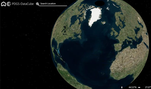
ESA PDGS DataCube
ESA's DataCube is a data catalogue that enables multi-temporal and pixel-based access to a subset of data available from ESA
Tools - Catalogues
 21 Oct 2022
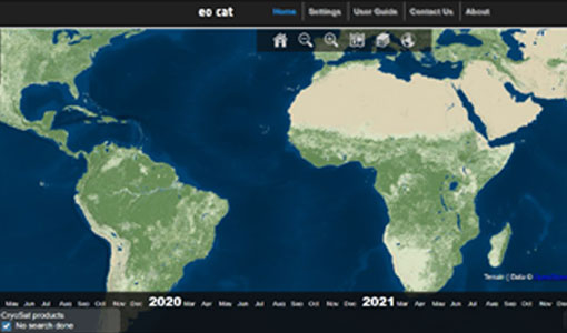
EO CAT
EO CAT is a data catalogue, offering a Next Generation Earth Observation system designed to manage end-user Earth Observation services.
Tools - Processing
23 Mar 2022Aeolus VRE
The Aeolus Virtual Research Environment (VRE) is the latest extension to the VirES for Aeolus service, which offers more direct and in-depth data exploitation of the Aeolus mission. The VRE is a cloud service that provides a web-based development environment in the form of a JupyterLab workspace.
Tools - Apps
 21 June 2021
CryoSat app for Android
Download the CryoSat application to discover what the mission is about, how it works and what the elements of the space and ground segment that makes this mission unique are.
Tools - Apps
21 June 2021CryoSat app for iPad
Download the CryoSat application to discover what the mission is about, how it works and what the elements of the space and ground segment that makes this mission unique are.
Tools - Apps
21 June 2021CryoSat app for iPhone
Download the CryoSat application to discover what the mission is about, how it works and what the elements of the space and ground segment that makes this mission unique are.
Tools - Apps
 21 June 2021
Heritage Missions app for iOS
Download the Heritage Missions application to discover what the missions were about, how it worked and what the elements of the space and ground segment that make these missions unique.
Tools - Apps
 21 June 2021
Heritage Missions app for Android
Download the Heritage Missions application to discover what the missions were about, how it worked and what the elements of the space and ground segment that make these missions unique.
Tools - Processing
 25 May 2021
SMOS Artificial Scene Library (ASL)
The ASL function allows users to directly use the L1B product version 7 by mimicking the Gibbs-2 image reconstruction correction algorithm as it is implemented in the level 1 operational processor.
Tools - Other
 6 May 2021
BioPAL
The Biomass Product Algorithm Laboratory (BioPAL) is an open-source scientific computing project, supporting the development of ESA's Biomass mission algorithms coded in Python.
Tools - Other
 8 Feb 2021
Food Security TEP
The Food Security Thematic Exploitation Platform (TEP) enables access, processing, uploading, visualisation, manipulation and comparison of data related to food security.
Tools - Other
 8 Feb 2021
Urban TEP
The Urban Thematic Exploitation Platform enables access, processing, uploading, visualisation, manipulation and comparison of data over urban areas.
Tools - Other
 8 Feb 2021
Hydrology TEP
The Hydrology Thematic Exploitation Platform (TEP) enables access, processing, uploading, visualisation, manipulation and comparison of hydrological data.
Tools - Other
 8 Feb 2021
Forestry TEP
The Forestry Thematic Exploitation Platform (TEP) enables users in the forestry sector to access satellite data based processing services and tools for generating value-added forest information products.
Tools - Other
 8 Feb 2021
Polar TEP
The Polar Thematic Exploitation Platform (TEP) enables access, processing, uploading, visualisation, manipulation and comparison of data over the polar regions.