
Featured
About ICEYE
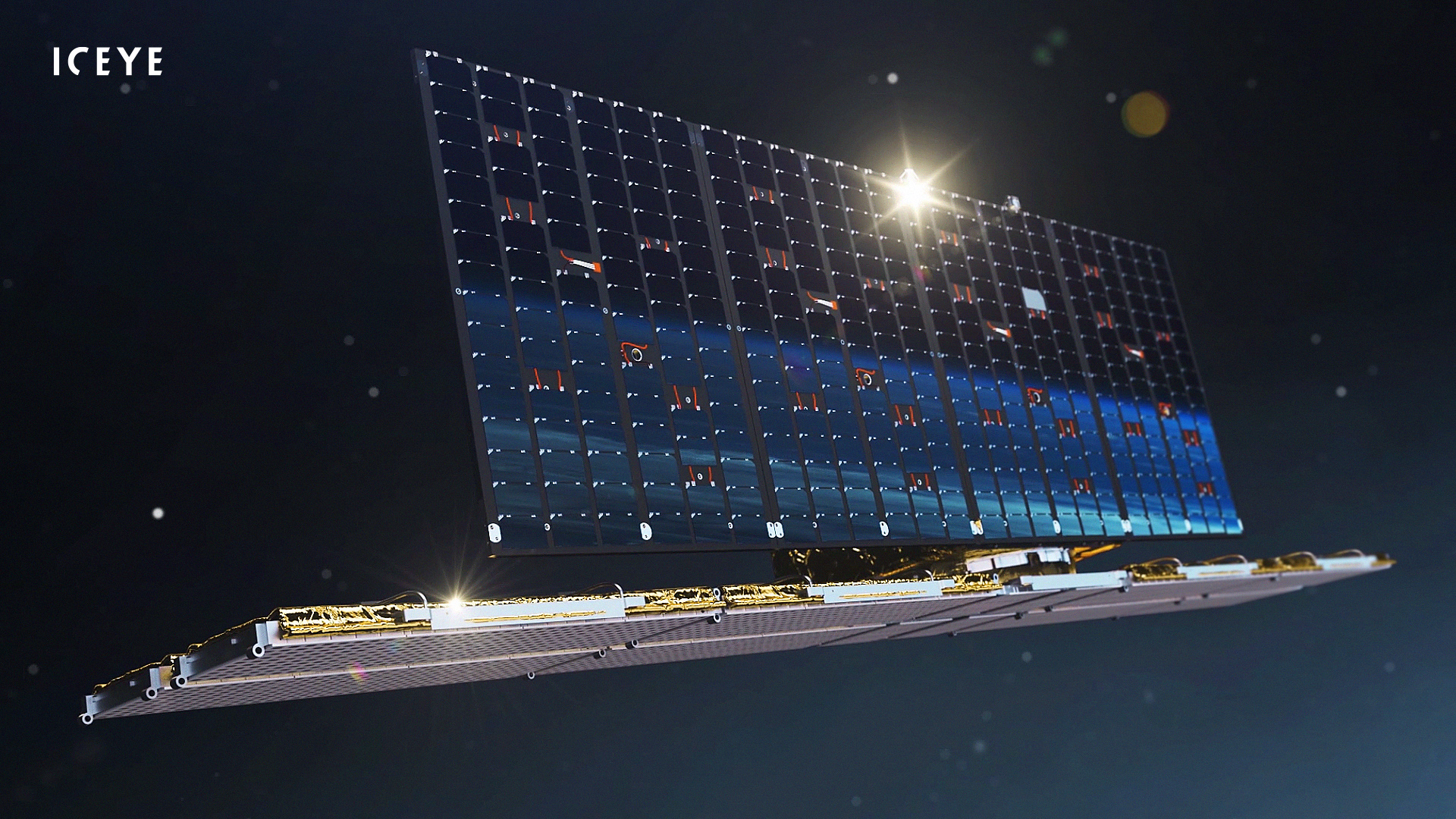
As of June 2023, 27 X-band Synthetic Aperture Radar (SAR) satellites have been launched for the ICEYE constellation. ICEYE will continue to grow its constellation capacity in specialised orbital planes designed to provide persistent monitoring capabilities and high resolution view of the Earth's surface. Four additional SAR satellites are scheduled to be launched by the end of 2023.
The ICEYE vision is to bring a new service to the market with an emphasis on superior reliability, a vastly higher rate of revisits to individual locations, and an unprecedented objectivity. The service is based on a completely new satellite and sensor design, leveraging recent advancement in various technologies and the New Space approach.
Each ICEYE satellite is in a sun-synchronous orbit with a nominal 1 - 22 day ground track repeat cycle (depending on satellite) with 15 imaging orbits per day. Each orbit plane is phased around the Earth with a different local time of ascending node (LTAN) and descending node (LTDN). This means that the constellation as a whole has the ability to observe a location at different times of the day rather than the more conventional dawn-dusk sun-synchronous orbit.
The flexibility of the satellites facilitates imaging modes to be constantly evolved. Currently, the satellites operate in five modes called 'Strip Mode', 'Spot Mode', 'Scan Mode', 'Spot Extended Area (SLEA) Mode' and 'Dwell Mode'.
| Orbit Parameters | Value |
| Nominal Altitude | 560 to 580 km |
| Inclination | 97.7° (sun-synchronous) |
| Orbits / Day | 15 |
| Ground Track Repeat | 1-22 days |
| Constellation Mean Revisit at Equator | 20 hours |
| Nodal Crossing | 15:05, 14:04, 21:36, 22:30 |
ICEYE Objectives

ICEYE's overall mission objective is to enable better decision making by providing timely and reliable Earth observation data. The company has been developing its own synthetic-aperture radar sensor technologies suitable for satellites under 100 kg in weight.
ICEYE Instruments
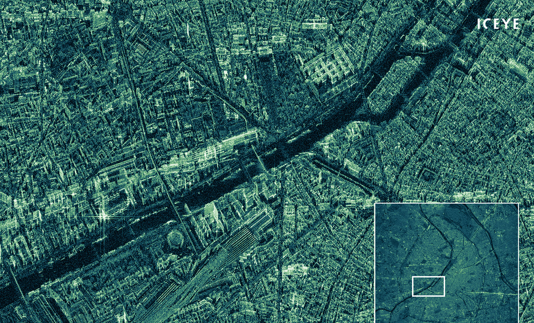
Synthetic Aperture Radar (SAR)
Each radar pulse can be digitally programmed to modulate over a bandwidth between 37.6 and 299 MHz (600 MHz for 3rd generation satellites) centred on the X-band (9.65 GHz) part of the spectrum. The pulse repetition frequency (PRF) can be selected between 2 and 10 kHz and the peak transmitted power can be as much as 3.2 kW.
The active phased array antenna can provide electronic beam steering. This is used in addition to the satellite's mechanical agility to point a radar beam precisely onto the Earth's surface. This agility also allows the beam to be directed towards the right or left side of the satellite track.
The instrument's nominal operating parameters are detailed in the table.
| Parameters | Value |
| Carrier Frequency | 9.65 GHz (X-band) |
| Look Direction | Both LEFT and RIGHT |
| Antenna size | 3.2 m (along-track) x 0.4 m |
| PRF | 2-10 kHz |
| Range Bandwidth | 37.6-299 MHz (600 MHz for 3rd generation) |
| Peak Radiated Power | 3.2 kW |
| Polarization | VV |
| Incidence Angle Range | 15-35 (mode dependent) |
| Mass | 85 kg |
| Communication (radar payload data downlink) | X-band 140 Mbits/s |
The flexibility of the satellites facilitates imaging modes to be constantly evolved. Currently, the satellites operate in five primary modes called 'Strip Mode', 'Spot Mode', 'Scan Mode', 'Spot Extended Area (SLEA) Mode' and 'Dwell Mode' with each mode providing different output imaging capabilities depending on tasking and exploitation requirements, as detailed in the table.
In Strip mode, the ground swath is illuminated with a continuous sequence of pulses while the antenna beam is fixed in its orientation. The beam is pointed off to the side of the satellite at an angle broadside to the satellite flight path. This results in a long image strip parallel to the flight direction.
In Spot mode, the radar beam is steered to illuminate a fixed point. This increases the illumination time and the length of the synthetic aperture, and it improves azimuth resolution.
Scan mode uses the phased array antenna to create multiple beams in the elevation direction. This beam steering means that points on the ground are not illuminated for as long, which reduces the resolution of a Scan product compared to Spot or Strip modes. This Terrain Observation by Progressive Scan (TOPS) technique is used to improve the overall image quality.
Spot Extended Area (SLEA) mode images a larger area than the standard Spot mode by pointing the satellite at a location that is further away. This spot is seen to “slide” over the ground which is why it is also known as Sliding Spot mode.
Dwell mode is a very long spot mode SAR collection with the satellite staring at the same location for up to 25 seconds. This yields a very fine azimuth resolution and highly-reduced speckle.
| Parameters | Strip | Spot | Scan | SLEA | Dwell |
| Nominal swath width (km) | 30 | 5 | 100 | 15 | 5 |
| Nominal product length (km) | 50 | 5 | 100 | 15 | 5 |
| Maximum Scene Length (km) | 600 | 5 | 100 | 15 | 5 |
| Incidence angle (scene centre) | 15-30° | 20-35° | 21-29° | 20-35° | 20-35° |
| NESZ (dBm2/m2) | -22 to -21.5 | -18 to -15 | -22.2 to -21.5 | -18 to -15 | -18 to -15 |
| AASR (dB)& RASR (dB) | -15 & -20 | -15 & -20 | -15 & -20 | -17 & -20 | -17 & -20 |
| Geospatial Accuracy [CEP90] (m) | 9 | 9 | 15 | 6 | 6 |
| Slant range resolution (m) | 0.5 to 2.5 | 0.5 | 0.5 | 0.5 | |
| Slant azimuth resolution (m) | 3 | 0.25 | 1 | 0.05 | |
| Slant range spacing (m) | 0.4 to 2.4 | 0.4 | 0.4 | 0.4 | |
| Slant azimuth spacing (m) | 1.6 | 0.2 | 0.2 | 0.05 | |
| Ground range resolution (m) | 3 | 1 | < 15 | 1 | 1 |
| Ground azimuth resolution (m) | 3 | 1 | < 15 | 1 | 1 |
| Ground range spacing (m) | 2.5 | 0.5 | 6 | 0.5 | 0.5 |
| Ground azimuth spacing (m) | 2.5 | 0.5 | 6 | 0.5 | 0.5 |
| Range looks | 1 | 1 to 24 | 1 | 1 | 1 |
| Azimuth looks | 1 to 2 | 1 to 4 | 1 | 1 | 20 |
| Complex product size (GB) | 3.4 to 2.9 | 0.6 to 0.8 | 0.6 to 7.2 | <15 | |
| ESA Copernicus Contributing Mission (CCM) Resolution Class (6) | VHR2 | VHR1 | HR1 | VHR1 | VHR1 |
| Polarization | VV | VV | VV | VV | VV |
ICEYE Data
DATA COLLECTIONS
For scientific research and application development, ESA is offering access to the full archive and new tasking of ICEYE data upon submission and acceptance of the project proposal.
ESA will support as many high-quality and innovative projects as possible within the quota limit available, therefore only a limited amount of products can be made available to each project.
The following collection is available:
ESA offers registered users the access to the Online Dissemination server to the following data collections:
Products
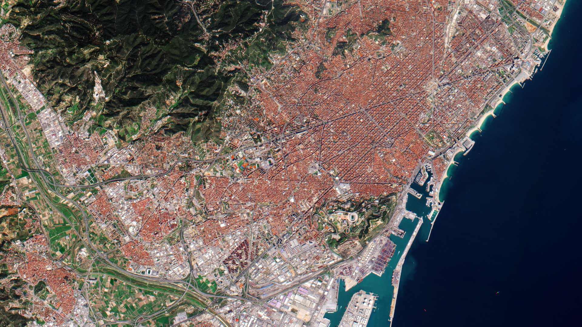
A basic ICEYE product is represented by a set of SAR image binary data along with the corresponding image annotation metadata, delivered as a singular product package. Products are characterised by the payload configuration (such as imaging mode and look direction) used by the respective satellite, as well as the level of processing that has been applied to the SAR scene. With respect to the data geometric projection and representation, Basic Image Products are differentiated into two primary product types, complex images (SLC) in the slant plane and amplitude images (GRD) projected to the ground surface.
SLC complex images contain pixels that have both amplitude and phase values. They are single-look images produced at full resolution and are projected in the inclined direction of illumination, called the slant plane. The pixels are aligned perpendicular to the sensor flight track, they are spaced equidistant in azimuth and in slant range.
GRD amplitude images have brightness values but no phase data. They are "multi-looked" to reduce the grainy effect of speckle, at the cost of slightly lower resolution. Amplitude images are projected on an ellipsoid model of the ground surface: the resulting product has approximately square spatial resolution and equal pixel spacing.
In both complex and amplitude images the native sensor geometry of range and azimuth is maintained and no image rotation to a map coordinate system is performed.
ICEYE Data Format
ICEYE data are stored and delivered in HDF5 files (SLC Complex data) and GeoTiff files (GRD Amplitude datas). HDF5 format is particularly suitable for storing binary complex SAR data channels along with annotated metadata. On the other hand, GeoTiff images are readily readable by common GIS software tools. Additionally, both SLC Complex and GRD Amplitude products are accompanied by xml-files containing metadata, thus enabling quick screening of products without the use of specialised software.
Detailed description of format for ICEYE data is given in the Level 1 Product Format Specification Document. Georeferenced ICEYE products are readable using specialised SAR software (e.g., ESA SNAP - S1TBX) where product orthorectification and further processing can be performed.
| SLC Complex | GRD Amplitude | Quicklook | |||
| Mode | Format | Size | Format | Size | Format |
| Strip | HDF5, XML | 3.4 to 2.9 GB | GeoTiff, XML | 700 MB | PNG, KML |
| Spot | HDF5, XML | 0.6 to 0.8 GB | GeoTiff, XML | 250 MB | PNG, KML |
| Scan | GeoTiff, XML | 800 MB | PNG, KML | ||
| SLEA | HDF5, XML | 0.6 to 7.2 GB | GeoTiff, XML | 250 to 1500 MB | PNG, KML |
| Dwell | HDF5, XML | <15 GB | GeoTiff, XML | 250 to 1500 MB | PNG, KML |