 Monitoring the Mount Vesuvius fires
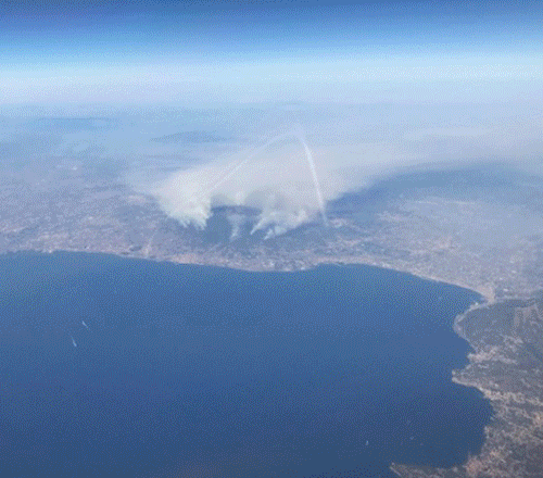
Italian firefighters have been battling numerous separate blazes on the slopes of Mount Vesuvius volcano near Naples. Tourists and residents have been evacuated for the second time in a week as a precaution after some observers thought the cloud of smoke was coming from the volcano itself. The flames have devastated pine forests and hectares of woodland in the area. At least 100 active fires through the Campania region are being tackled by around 600 fire fighters and civil protection workers. Although arson in some cases hasn't been ruled out, dry weather and strong winds have certainly played their part. More information is available on Euronews
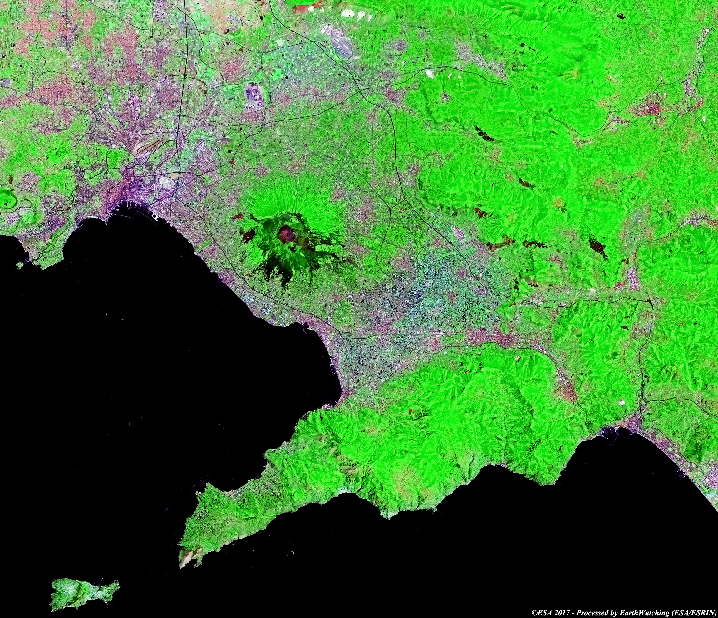
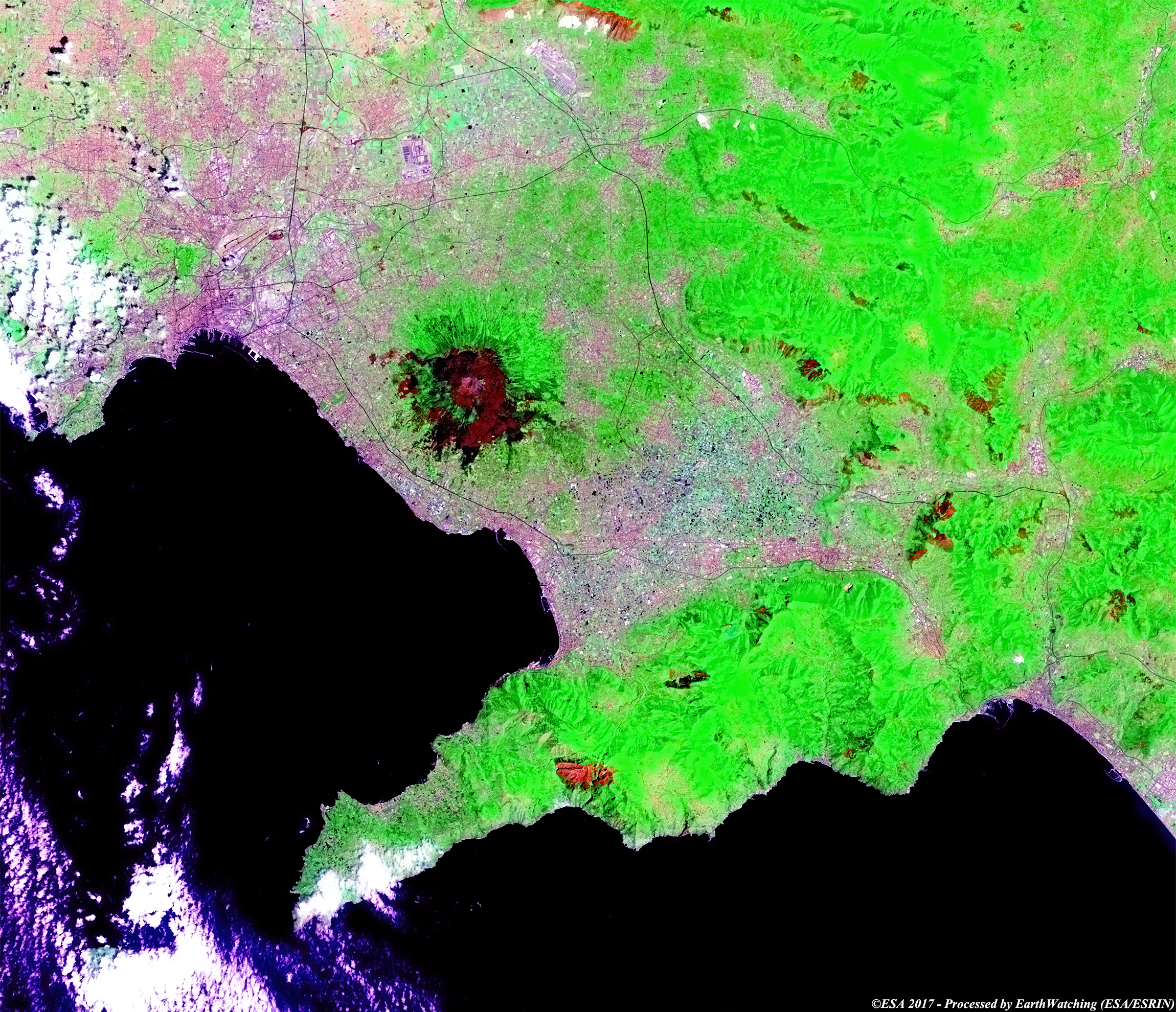
This week Landsat 8 examines the fires that have destroyed part of the forest around Mount Vesuvius Volcano and an area on the Amlfi coast (center lower image north of Positano village). The purpose of this image comparison, acquired in a time window of 16 days (before/after), is to show the large area around Vesuvius that has been affected by the fires so far in July. In this comparison created with bands in false colour, it is possible to see the large area burnt in dark brown. This band combination makes it easy to see the considerable damage to the vegetation. Another aim of these images is to promote the opportunity to download Landsat data through the ESA portals, where images captured every day are made available in near real time to the users and the scientific community. Landsat full resolution data products are freely available for immediate download at: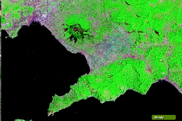 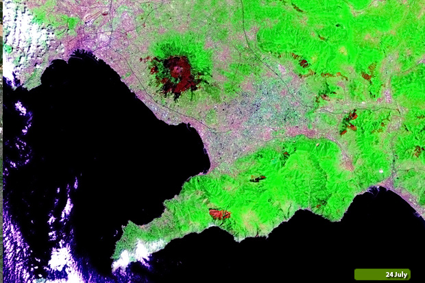 View Landsat 8 OLI large format slider View high resolution image (8 July 2017) (JPG 5.0 MB) View high resolution image (24 July 2017) (JPG 5.0 MB)
In these Sentinel-2 images acquired through a combination of optical bands in false colour, we aim to show the area around Mount Vesuvius Volcano destroyed by fires. In the comparison it is possibile to see the scale of the area destroyed by fire. The area burned is visible in black around the Volcano and also north of Positano village (lower center area of the image). With this demonstration of images, we aim to show the large field of application that the Copernicus missions offer. 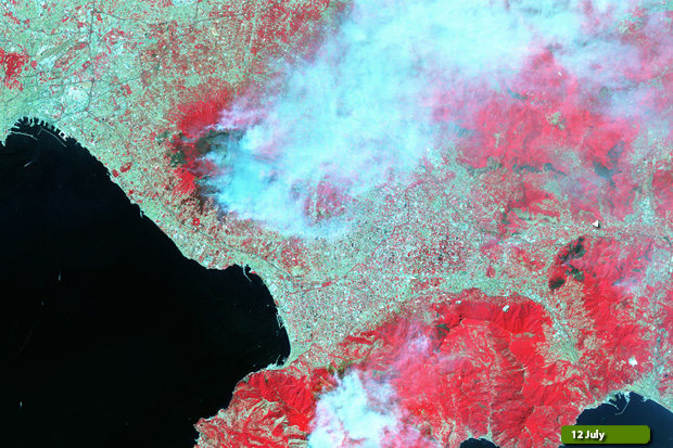 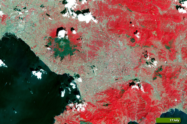 View Sentinel-2 large format slider View high resolution image (12 July 2017) (JPG 8.5 MB) View high resolution image (17 July 2017) (JPG 9.7 MB)
|
||||||||||||||||||||||||||||||||||