 Crimean Bridge, Crimea
This week's images were acquired by the optical satellite Copernicus Sentinel-2 and were processed in natural colours. The images were acquired two years apart and show the Crimean Bridge, in the Kerch Strait, which connects the Black Sea with the Azov Sea. The strait separates the Kerch peninsula in the west and the Taman peninsula in the east. Proposals to construct a bridge crossing the strait had been considered since the start of the 20th century, but it wasn't until 2014 that a project was accepted and work began in 2015. In May 2018, the bridge was inaugurated for road transit, and since then the bridge has also been engineered to enable rail use. Today the bridge consists of a double road and railway structure. 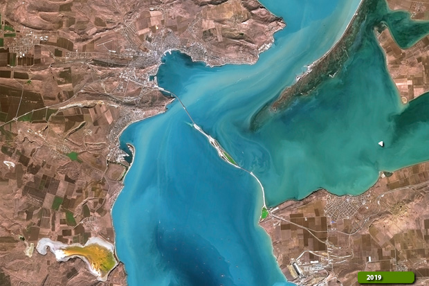 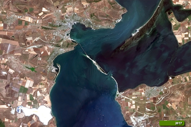 View high resolution image (Before) (JPG 5.4 MB) View high resolution image (After) (JPG 5.0 MB)
|
||||||||||||||||