 Browse SAR Events by Year
20 Years of SAR
Browse SAR Events by Year
20 Years of SAR
 View large format jpeg (205 Kb)
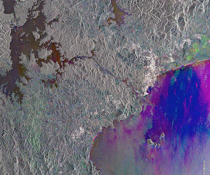
Panama Canal This ERS-2 PRI radar multicolour composite image was acquired over the Panama Canal, located in Central America, the canal across the strait of Panama (centre image). Created by artificially joining Gatum and Alajuela lakes (top left), the Panama canal connects the Caribbean Sea (Atlantic Ocean) with the Gulf of Panama (Pacific Ocean), eliminating the need for shipping to travel around South America. Located at the end of the canal, Panama City is visible as a large bright area along the Gulf. The Chagres River (top right image) supplies the water needed to operate the locks of the Panama Canal. Technical Information:
Coordinates:
NE Lat/Long: N 09.24 / W 80.05 |
||