Northern Europe, July 2002 - A week of continuous heavy rains devastated Northern Europe, killing dozens of people, leaving thousands more homeless and causing damage worth billions of dollars.
The worst-affected areas are; Czech Republic, Austria, Germany, Slovakia, Poland, Hungary, Romania and Croatia.
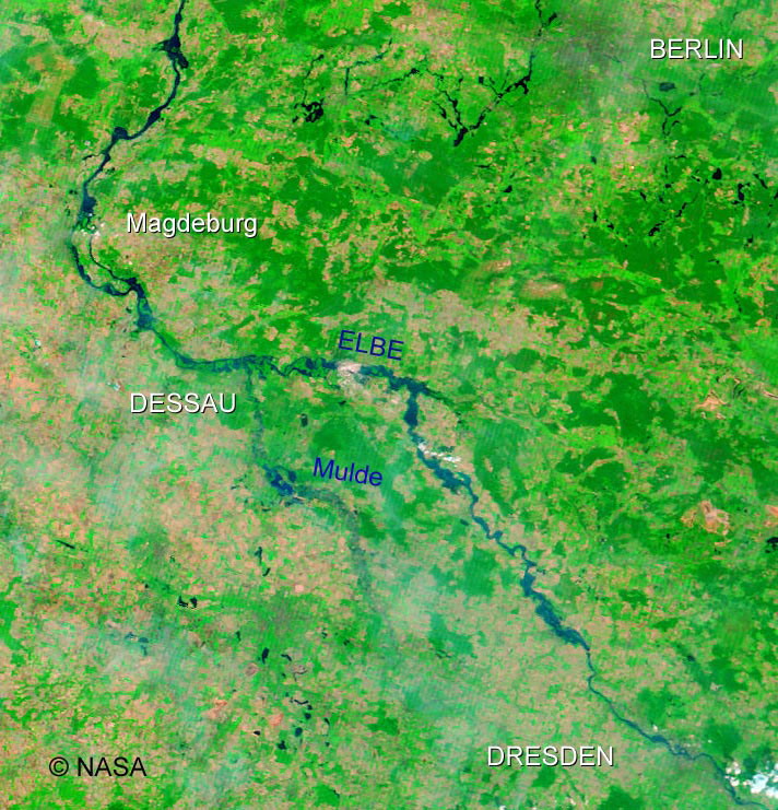
Several rivers were also affected in these regions; Elbe, Danube, Havel and Vltava reaching record breaking highs.
A series of ERS, Envisat and Terra MODIS images were acquired during the flooding event.
The coloured frames on the map show the acquisitions from which the images below are derived. The images are divided by colour to indicate which area the images refer to on the map.
|
Event Timeline |
|
Light Blue |
|
CZECH REPUBLIC |
|
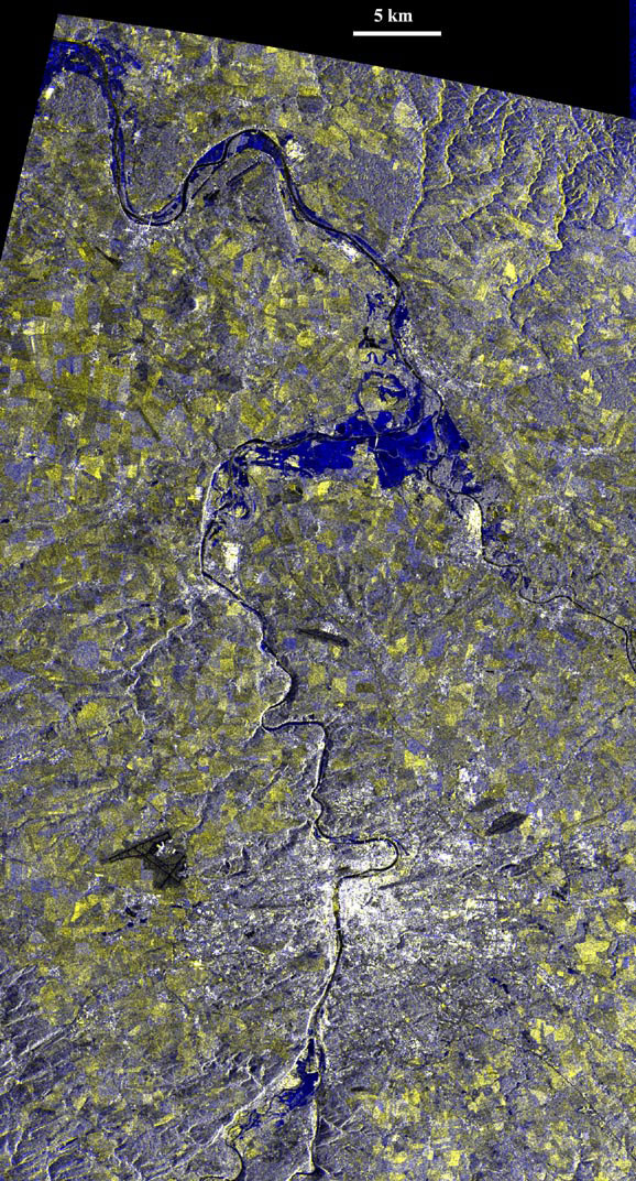
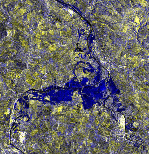
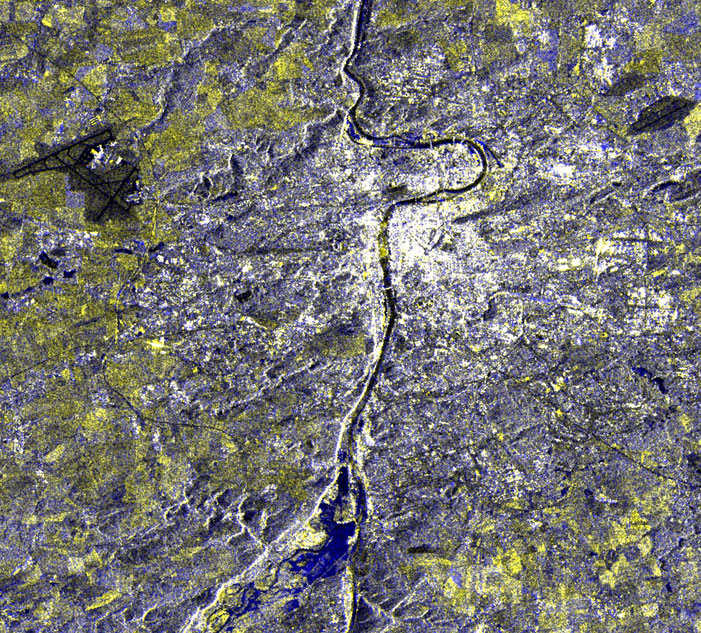
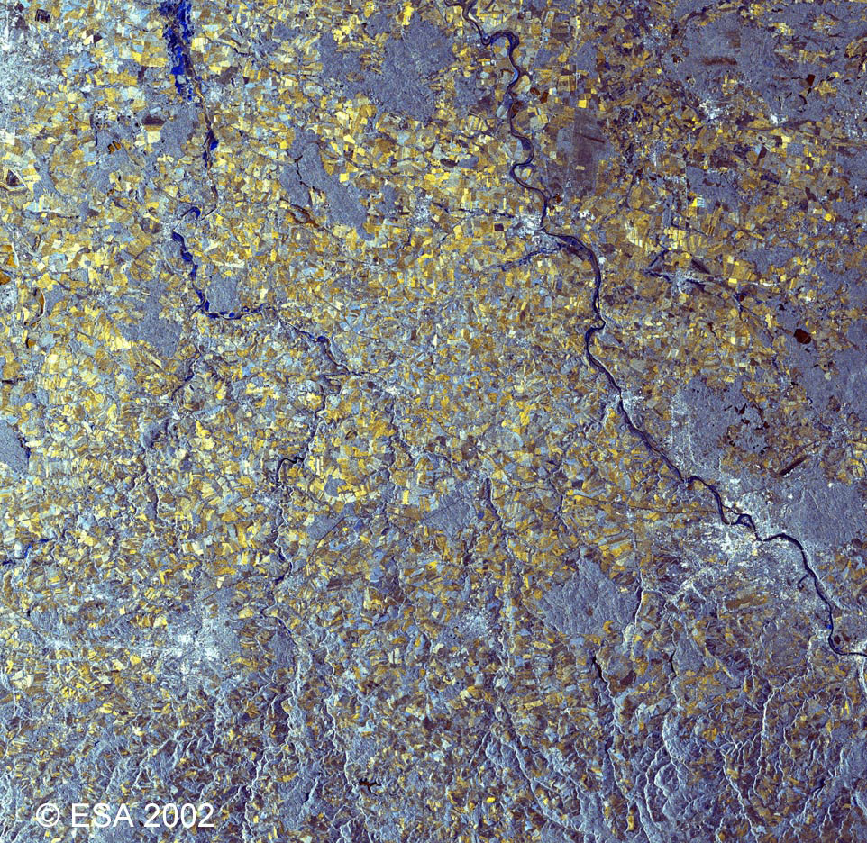
This ERS-2 multi-temporal image was created using two acquisitions; 16 August 2002 (orbit 38281) and 13 August 1998 (orbit 17329). |
|
Magnified view of Vtlava-Elbe conjunction |
|
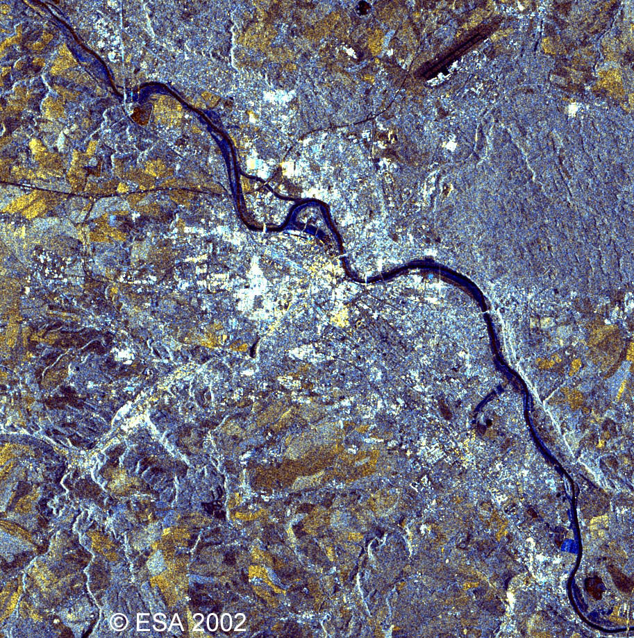
Magnified view of Prague and the Vltava River |
|
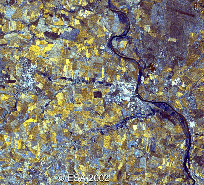
This ERS-2 SAR multitemporal image (13 August & 9 July 2002) shows the Dresden area (Red 13/08/2002, Green 09/07/2002, Blue Principal Component). |
|
Magnified view of Dresden |
This image shows a closer view of Dresden. The areas of the image highlighted blue indicate floodwaters, and the black areas show ordinary bodies of water.
This Envisat ASAR image was acquired on 19 August 2002, 9:30 UTC, Orbit 2452 around the town of Dresden (bottom right, bright yellowish points) along the Elbe river.
The image is taken in Alternate Polarisation mode and the colours are given by the different polarisation (Red HH, Green HV, Blue Difference between the two). Water-covered areas are clearly visible in blue and, around Riesa town, flooded areas are quite large. This image was reduced for volume reasons. The original image has a spatial resolution of about 25 metres. |
|
This ERS-2 SAR multitemporal image was acquired on the 19 August 2002, 10:00 UTC (just half an hour after the Envisat image above), orbit 38324 frame 2572 and 10 August 1998, orbit 17282 as reference. It was shows the area around the city of Dresden (bottom right, bright points) along the Elbe river. Flooded areas are clearly visible in blue. |
|
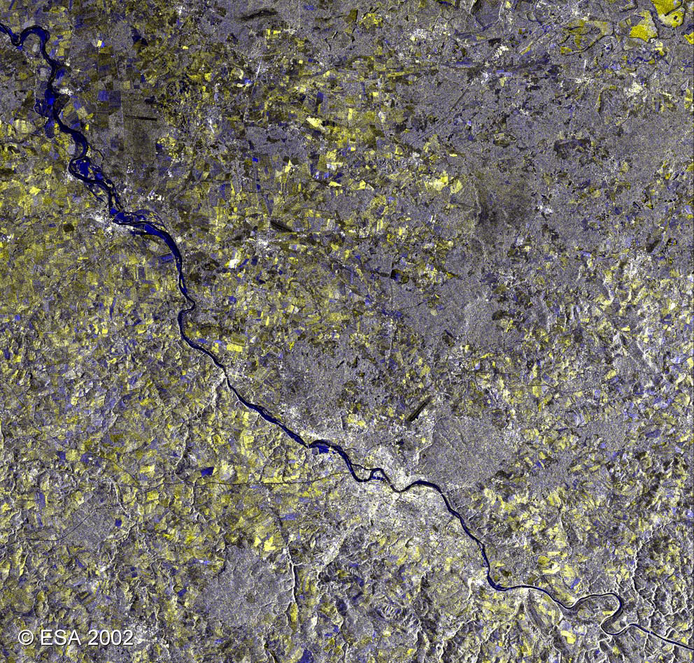
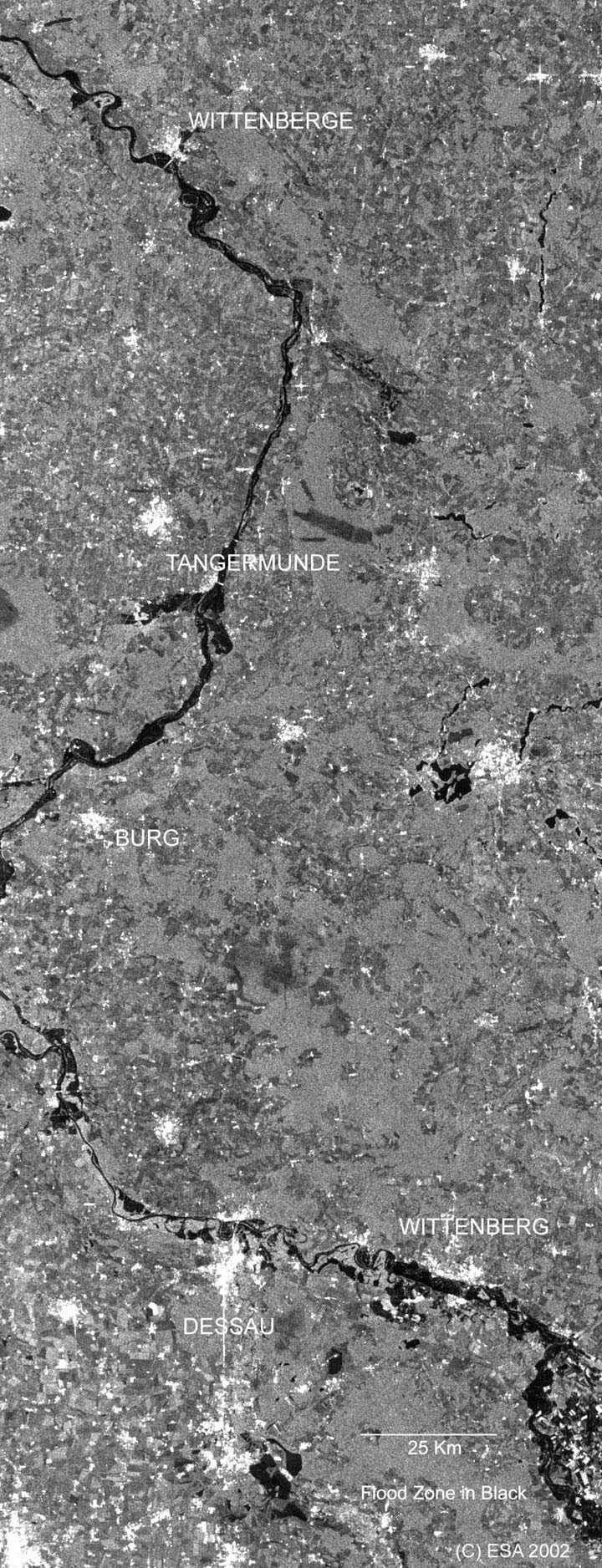
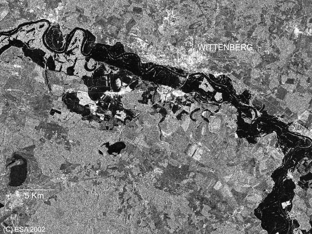
This Envisat ASAR Image Mode, pol. HH swath 4 was acquired on 19 August 2002, at 20:53 UTC over Elbe valley between Wittenberg and Wittenberge. |
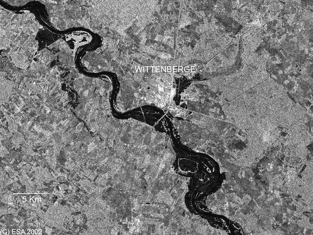
This image shows a magnified view of Wittenberge.
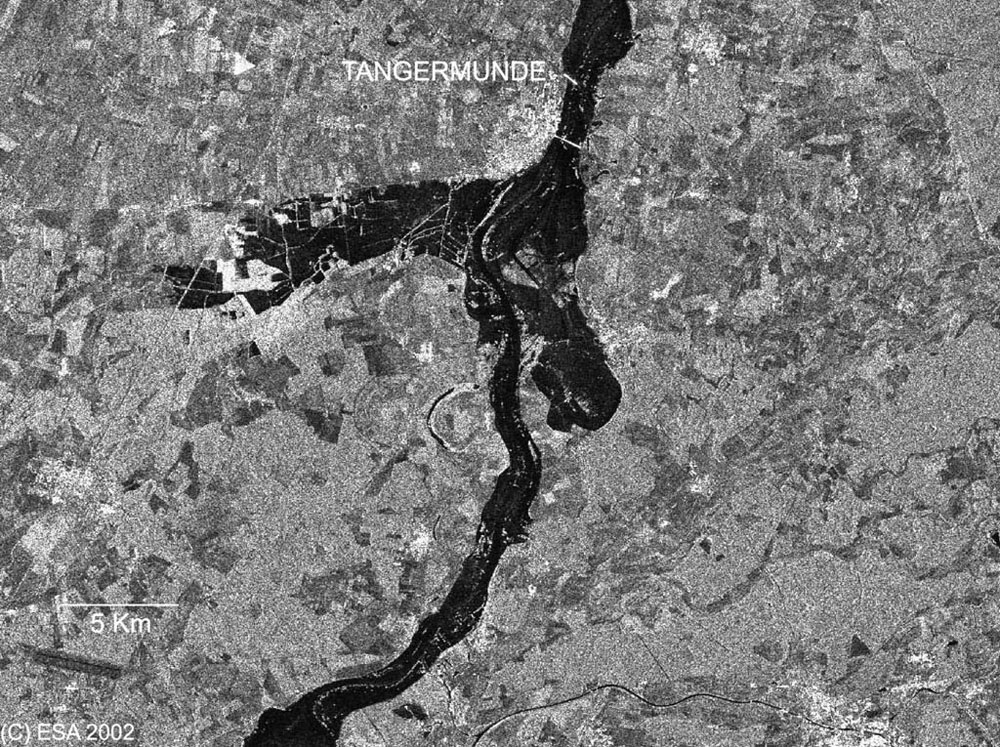
This image shows a magnified view of Tangermunde.
This image shows a magnified view of Wittenberg.
|
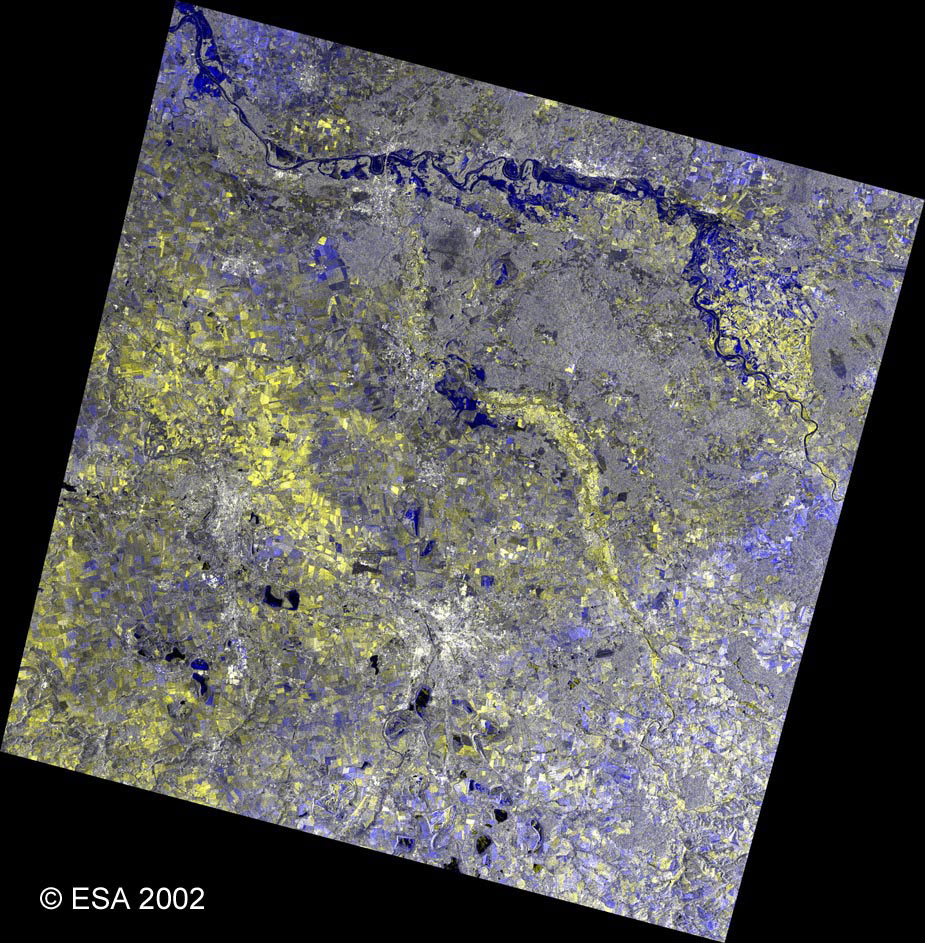
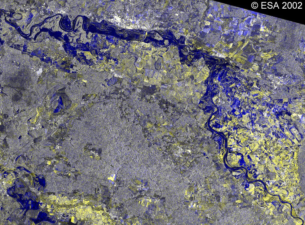
This ERS-2 SAR multitemporal image over the Elbe and Havel rivers was acquired on 22 August (ref. 13 August 1998). The city of Berlin is clearly visible at the top-left of the image. |
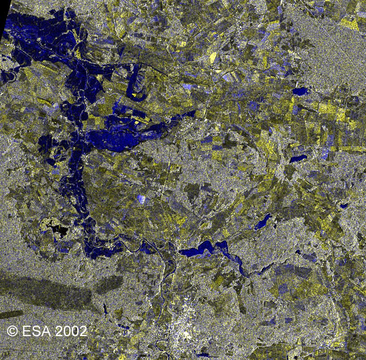
This image shows a magnified view of Rathenow on the Havel River.
This image shows a magnified view of Dessau (bottom left of the image) and Roslau (centre of the image toward the left).
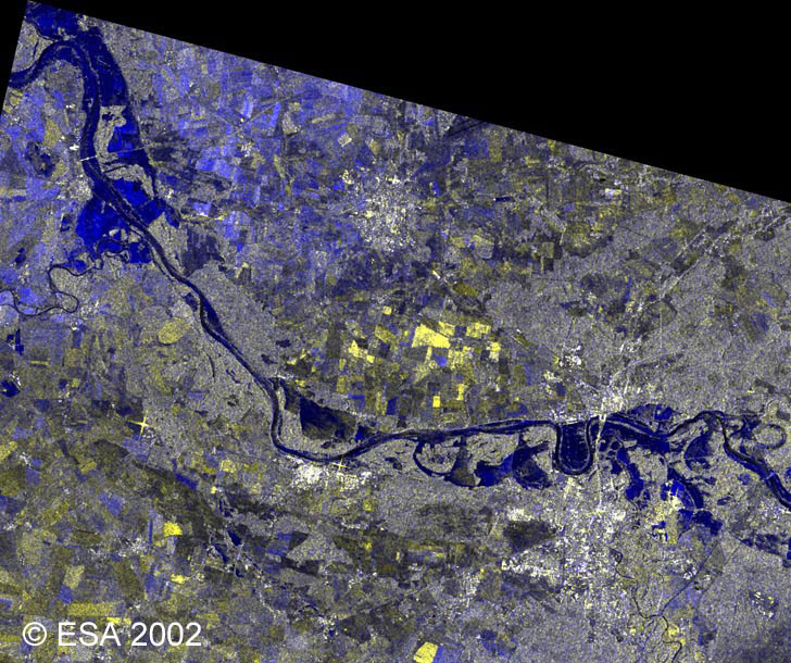
This image shows a magnified view of Wittenberg.
|
Red |
|
CZECH REPUBLIC and AUSTRIA |
|
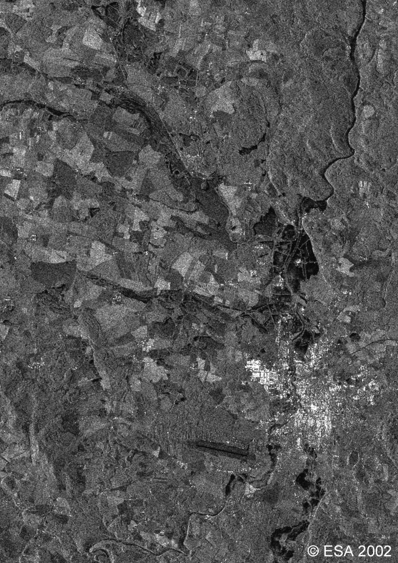
This ERS-2 SAR image was acquired on 16 August 2002 over Czech Republic. The bohemian town of Ceske Budejovice (known as Bohmisch Budweis), at the junction of the Vtlava and Malse rivers, is visible on the right of the image. |
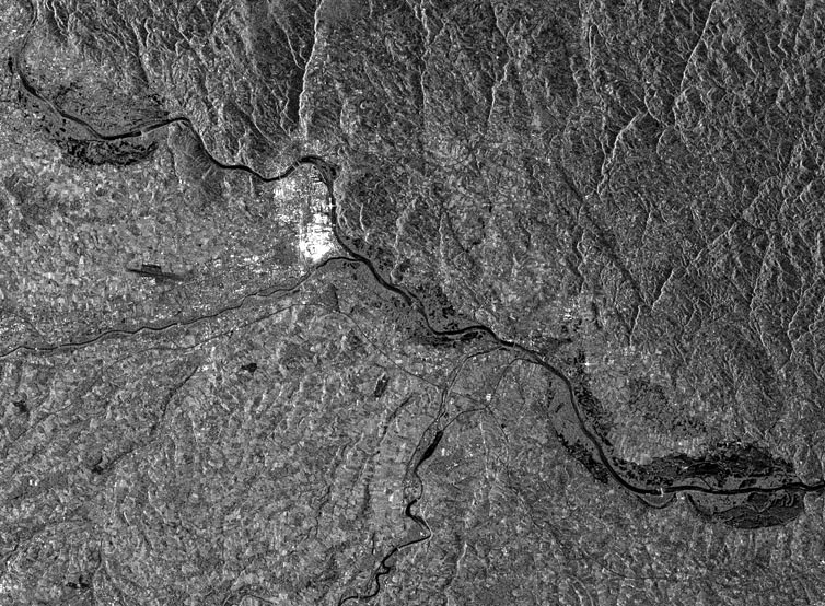
This ERS-2 SAR image was acquired on the 16 August 2002 over Austria. The town of Linz, on the Danube river, is clearly visible as a cluster of very bright points.
These two Terra images, acquired by the MODIS instrument on 18 August 2002 cover a wider area than the above ERS and Envisat images.
This first image shows flooding along the Elbe River in Germany. |
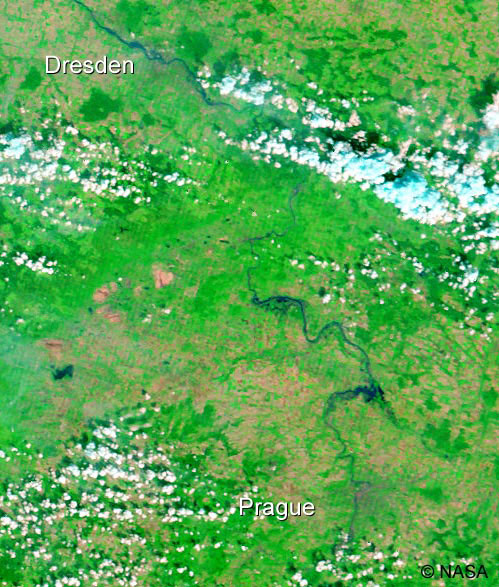
This second Terra image shows an area further south, between Prague in Austria and Dresden in Germany.
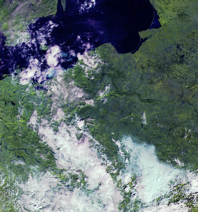
These Envisat MERIS images also cover a wider area over most of northern Europe.
This first image is a Reduced Resolution product acquired on 16 August 2002. |
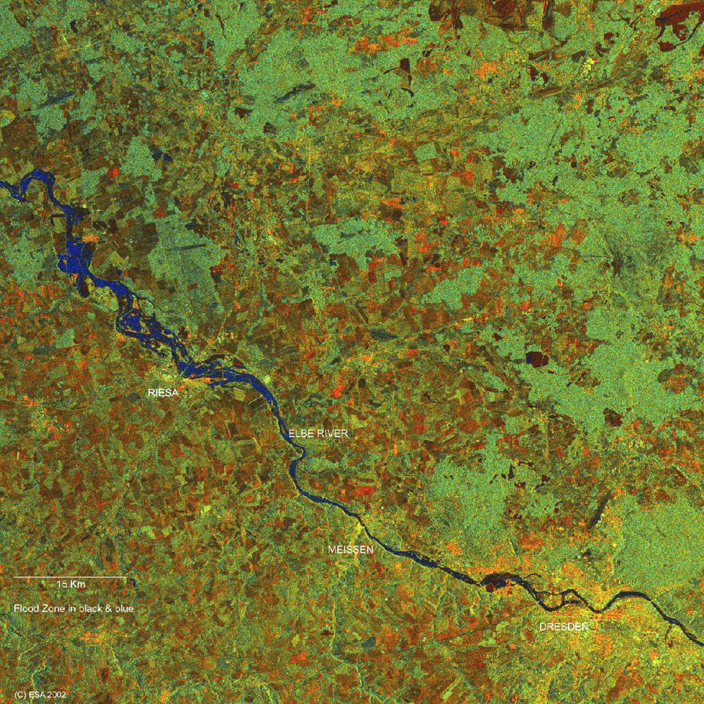
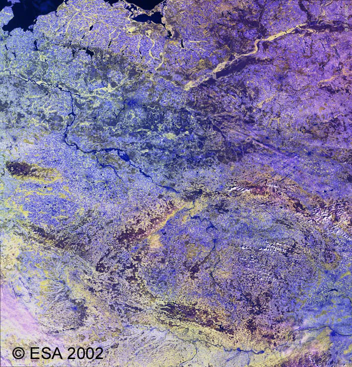
This second Envisat MERIS Full Resolution image is centred on the Elba river, crossing the Czech Republic and Germany from the South East to the North West, acquired on 19 August. Part of the Danube river in Austria is also visible at the bottom right. This image is a spectral combination of MERIS bands 15, 13 and 9, respectively centred at 900 nm, 865 nm and 708.75 nm. The image is down-sampled for size reasons.
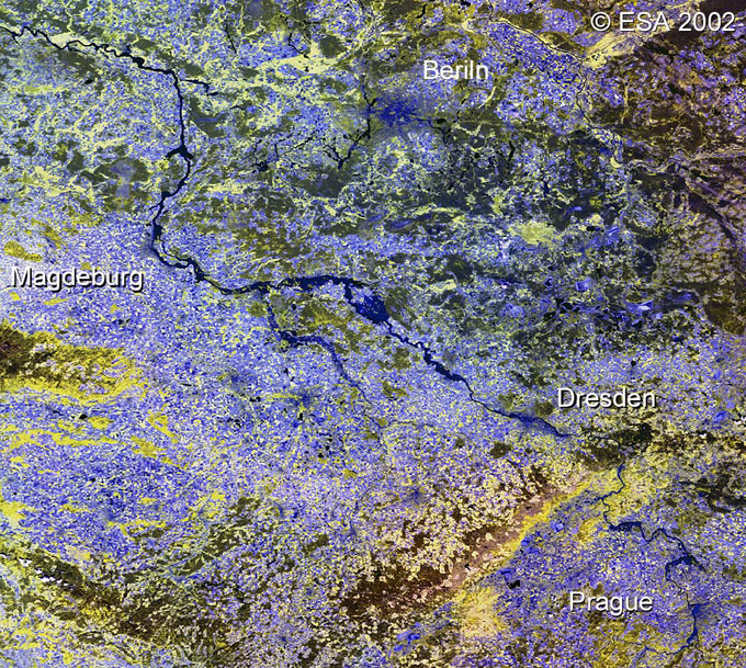
This image shows a magnified view of the Elbe river region. The rivers, the flooded areas and the towns are visible in blue. The pixel size of this down-sampled image is around 400 m.
Back to top
 Browse SAR Events by Year