 Browse SAR Events by Year
20 Years of SAR
Browse SAR Events by Year
20 Years of SAR
 View large format jpeg (266 kb)
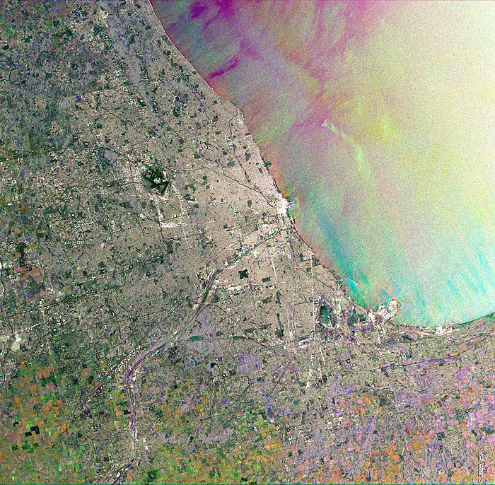
Chicago USA This Synthetic Aperture Radar (SAR) multitemporal colour composite image is centred over the city of Chicago, located in northeastern Illinois at the southwestern tip of Lake Michigan. Most of the city's landmarks are visible in the image such as: the long dark line coming into the center of the city from the southeast is the Chicago Sanitary and Ship Canal, the O'Hare International Airport (north of the river) and the Midway Airport (south), the Navy Pier that juts out onto the lake just north of the river. Visible also is that the city has been built on relatively flat land (the average height of land is 176 metres above sea level) and the various colour patches sparse to the southwest and south of the city indicating cultivated agricultural fields. The image is made of three ERS-2 SAR PRI (Precision Radar Image) images acquired on different dates and assigning a colour (RGB) to each date of acquisition. Technical Information:
Coordinates:
NE Lat/Long: N 42.16 / W 87.03 |
||